Sitges Map: Old Town, Stations and Sights Laid Out
A visitor's Sitges map guide: the old town and seafront by area, where the tourist office sits, which free maps to pick up and how to plan a short walk.
On this page
Sitges is small enough that one good paper map covers the whole visit, and the free sheet from the tourist office on Plaça Eduard Maristany does exactly that. Collect it on arrival, then walk the old town in a single loop rather than mapping routes across town. This guide explains what each free map shows, which one suits a day of wandering, and how the station, seafront and sights sit on the paper, and it slots into the wider set of things to do in Sitges.
What a Sitges map shows you at a glance
The town centre is compact, with the historic core and the seafront pressed together, so a single map reads as one dense cluster rather than a sprawl. The tourist-office map prints a whole-town view on one side and a closer centre plan on the other, which lets you judge how far your accommodation sits from the sights before you set off. Keep the centre side facing up while you walk, and use the wider side only for planning the edges of town.
Because the centre is so tightly packed, distances between the church, the museums and the seafront promenade read as minutes rather than kilometres on the plan. That makes a printed map more useful than a phone screen here: you can see the whole core at once and pick a route that does not double back. Fold it to the centre side and keep it in a pocket rather than planning on the hoof with a screen.
The old town: the compact core you can walk in one loop
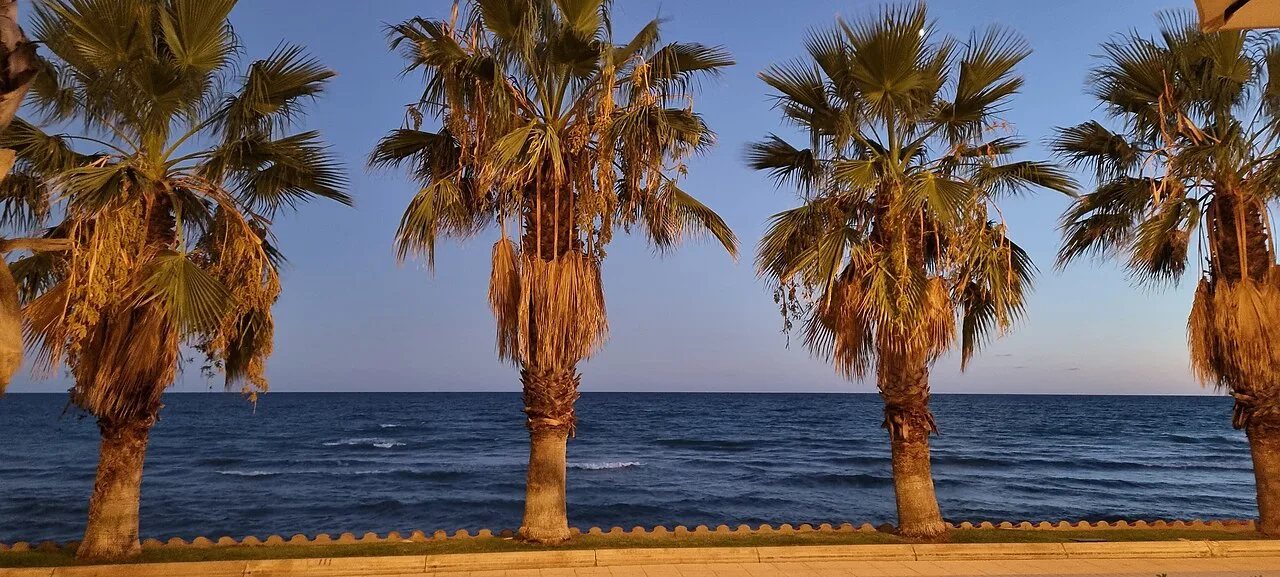
The historic centre is the part to map first, because almost everything worth seeing sits inside it. The tourist board publishes a dedicated route through the casco antiguo, which gives you a ready-made order for the streets instead of a scatter of pins. Start from the seafront end and work inland, so the return leg runs downhill towards the water.
Sitges Anytime also publishes a route around the Americanos houses, the villas built by returning emigrants, which spreads beyond the tightest lanes and gives the map a second, shorter loop. If you only have an afternoon, pick one of the two routes rather than both: the old-town loop keeps you in the core, while the villa route pulls you along the grid of wider streets. Read both on the centre plan before choosing.
Where to pick up a free Sitges map
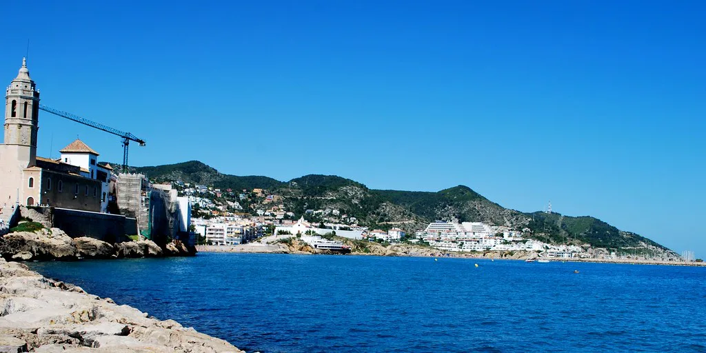
The main tourist office sits on Plaça Eduard Maristany, and staff there hand out maps and will mark a route or a location on the sheet for you. Most of the maps on offer are free, and many shops and museums around town also keep a stack, so you are not stranded if you arrive outside opening hours. Ask for the centre plan specifically if you plan to walk rather than drive.
If you want the map before you travel, the tourist board publishes a downloadable tourist map of Sitges, and the Sitges Convention Bureau also offers a map download. Either saves you the first stop of the trip: print the centre side, mark your accommodation, and arrive knowing which way to turn out of the station.
Tourist office opening hours and the station information point
The tourist office opens Monday to Saturday from 10:00 to 14:00 and again from 15:00 to 19:00, with a shorter window of 10:00 to 14:00 on Sundays and public holidays. That midday gap matters: arrive after the morning close and you may find the shutters down for an hour. Plan a museum visit across the break rather than standing outside.
The information point that used to sit outside the train station is no longer open, so arrivals should head to Plaça Eduard Maristany for maps and advice instead of looking for it on the platform side. Budget the walk into the centre before you start looking, and use the map you downloaded on the train to find the office.
Which free map to take
Three sheets are worth knowing. The large illustrated tourist map is the planning tool: one side shows the whole of Sitges, the other zooms into the centre with small pictures and a key marking churches, museums and galleries, and numbered circles locate hotels, apartments and campsites. Take this one if you want to see how the town and its outskirts relate.
The small black-and-white map is the one for your pocket: it does not unfold into a sheet, it is easier to handle in the narrow streets, and it still carries numbered accommodation circles plus symbols for the post office, hospital and train station. Take both if you like, but the small one is the walking map. The Gay Life map, recognisable by its rainbow cover, plots gay accommodation, bars, clubs, restaurants, shops and saunas on a centre plan, with a paw-print symbol beside places that serve gay men only.
Getting your bearings on arrival
From the station, the centre and seafront lie on the seaward side of the tracks, so orient yourself by heading downhill towards the water and using the map to pick the street that lands you nearest your accommodation. The small black-and-white map marks the station itself, which makes it easy to retrace your steps at the end of the day. If you are driving, the large tourist map's whole-town side shows where the edge of the centre begins, and the tourist office on Plaça Eduard Maristany is the sensible first stop for parking guidance nearby.
Trains from Barcelona and the airport run into Sitges station, which is why so many visitors arrive without a car and on foot. Mark the station on your printed map before you leave home, then trace the short route to the tourist office so the first ten minutes of the trip are not spent guessing.
Finding the sights on the map
The illustrated centre plan uses a picture key to place the main churches, museums and galleries, so you can spot a cluster and walk it in one go rather than criss-crossing. The Museu del Cau Ferrat and the other art collections sit inside the old town, which means one map reading covers several sights at once. Pick a starting sight, note the two nearest others, and let the loop do the rest.
For shopping, the centre plan shows the commercial streets clearly enough to fold a browse into the same walk, with Avinguda Artur Carbonell and the lanes around it easy to locate. Keep the map out and the route loose: the pleasure of Sitges is turning a corner into a Plaça you had not planned for.
Planning a walking route without overreaching the town's size
One loop of the old town plus a stretch of seafront is a realistic half-day on foot, and the map's centre side is all you need to plot it. Draw the loop before you leave: church, a museum, the seafront, then back through the lanes, so you never walk the same street twice. Resist adding the villa route on the same day unless you are content to skim both.
The map also makes it easy to judge when to head for the water: the seafront runs along one edge of the centre, so any inland street will eventually bring you back towards it. Use that as your reset point when you lose your bearings in the lanes. For a different view of the coastline, a boat trip leaves from the seafront, and the map's edge is where you will find the departure point.
Using the map to link Sitges with Barcelona
Sitges sits on the coastal rail line south of Barcelona, so the station on your map is the link for both city and airport journeys. Trace the walk from your accommodation to the station once, at leisure, rather than on the morning you leave with luggage. The whole-town side of the large map shows how the built-up area meets the coast road, which helps you place the town relative to Barcelona when you look at a regional map.
If you are weighing a base in Barcelona against a base in Sitges, the map answers the practical question: how much of the day goes on the train and how much on foot in town. Keep the station-to-centre walk in mind when you book, and treat the map as a tool for that decision rather than a souvenir.
Which map to print before you leave
Print the centre side of the tourist board map, collect the small black-and-white sheet at Plaça Eduard Maristany, and you have Sitges covered for a short break. The old town loop plus the seafront is the route to draw first. Confirm the office hours on the day you travel, then let the map do the rest.
Explore more Sitges guides
Frequently Asked Questions
Can I get a Sitges map before I arrive?
Yes. The tourist board publishes a downloadable tourist map of Sitges, and the Sitges Convention Bureau also offers a map download. Print the centre side so you can mark your accommodation and the walk from the station.
Is there a tourist information point at Sitges train station?
The information point that used to sit outside the station is no longer open. Head to the main tourist office on Plaça Eduard Maristany for free maps and advice instead.
Which free Sitges map is best for walking the old town?
Take the small black-and-white map: it does not unfold into a large sheet and is easier to handle in the narrow streets, and it still marks the station, post office and hospital. The large illustrated map is better for planning the whole town.
Sources
Notes for your next Spanish town break
Optional updates to our guides.
You might also like
Continue reading
More guides you'll find useful