
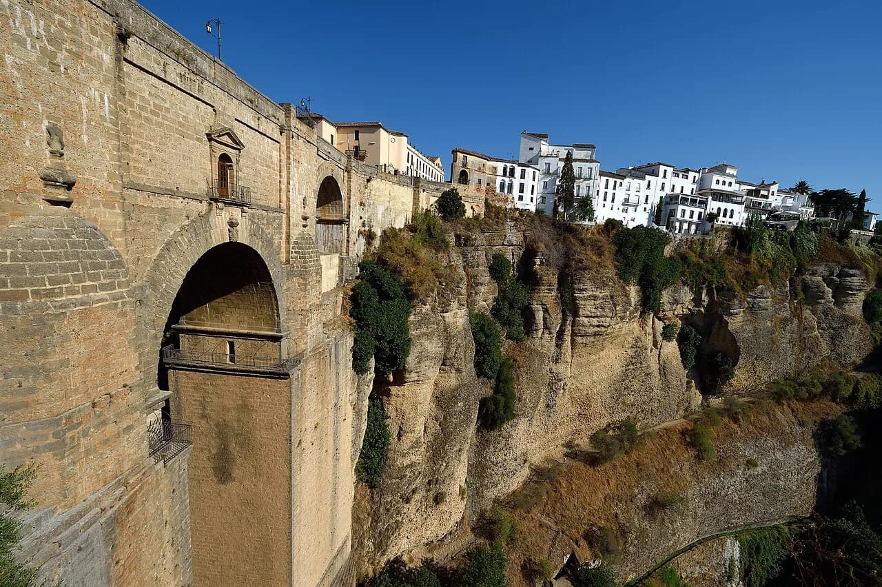
Puente Nuevo, Ronda: visiting the bridge over the Tajo

Puente Nuevo is Ronda's bridge over the Tajo, the gorge that splits the town in two, and it is the single structure that explains why the rest of Ronda is laid out the way it is. Allow roughly two hours to see it properly from the viewpoints and to add the interpretation museum, more if you continue into La Ciudad. This guide covers where the bridge stands, which viewpoints look at it from which side, and what sits within a few minutes' walk of it.
The bridge is best understood as part of the gorge rather than as a monument you visit and leave: the streets on both rims, the paths down the sides and the river at the bottom all change how the structure reads. Museum hours, guided visit times and monument passes are published seasonally by Ronda's tourism office, so check the current listings there before you build a day around them.
What Puente Nuevo is and why it defines Ronda
Puente Nuevo is the high bridge spanning the Tajo, linking the newer part of Ronda around the Plaza de España with La Ciudad, the old Moorish quarter on the far rim. Its name means "New Bridge", a reminder that it replaced earlier crossings rather than being the town's first. Almost every mental image of Ronda is taken from one of the ledges below the rim, looking up at the arch and the cliff face it springs from.
Because the bridge is a road bridge in daily use, you cross it rather than queue for it: there is no turnstile, no ticket window and no single entrance. What you are really choosing between is the various positions from which it can be seen, and those sit at different heights and on different sides of the gorge, which is why a short walk around the bridge delivers more than a crossing does.
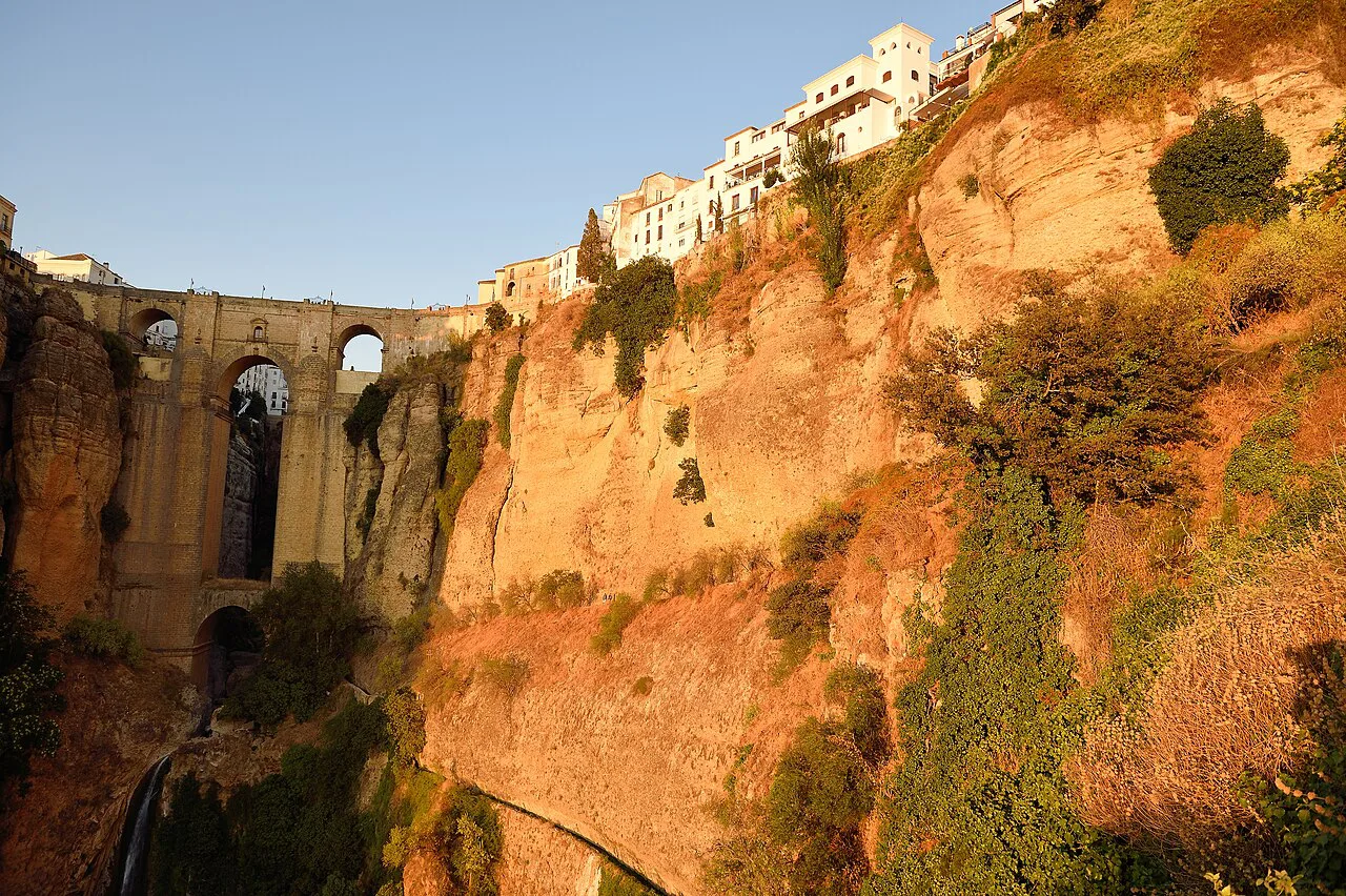

Where it is: the Tajo gorge and the streets on either side
The bridge sits directly off the Plaza de España, the square that acts as the hinge between Ronda's modern centre and the old town. On the northern side the streets are broader and busier with traffic; on the southern side, La Ciudad begins immediately with narrow lanes, whitewashed fronts and church towers. Crossing the bridge is effectively crossing from one Ronda into the other.
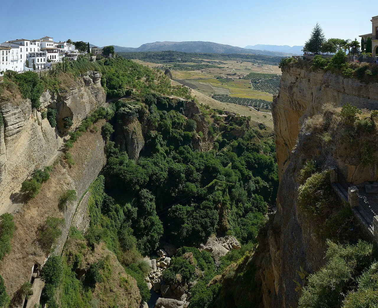
The Tajo itself is the deep cut the Guadalevín has carved through the plateau, and the town has grown along both of its rims. Buildings on the edge sit almost flush with the drop, which is why so many of the best-known views of Ronda are had from ordinary streets and small terraces rather than from formal attractions; walking the rim streets is one of the most direct ways to grasp the geography of the place.
The river below and how the gorge shapes the town
The river running through the bottom of the Tajo is the Guadalevín, and it is the reason Ronda is where it is: the water cut the gorge, and the gorge made the site defensible. From the rim you can usually pick out the river far below, though the angle and the vegetation hide stretches of it. The drop is what gives the bridge its drama, and the river is what gives the drop its cause.
That geography explains the town's shape. The historic core crowds the southern rim because that side was the fortified settlement, while the northern side grew later around the square and the road out towards the coast. Once you have stood at a rim viewpoint, the walk into La Ciudad stops feeling like an arbitrary wander and starts reading as a boundary line.
How to get there on foot from Ronda's old town and La Ciudad
From La Ciudad, walk downhill through the old lanes towards the Plaza de España and you will reach the bridge at its southern end, a few minutes from the main churches and palaces. From the newer town, the Plaza de España is the natural starting point, with the bridge immediately to the south. Arrivals by train reach the bridge on foot through the newer streets on the northern side.
Ronda's tourism office publishes a town plan in several languages along with bus and train timetables, which is the most reliable way to fix your arrival and departure around a bridge visit. Use those published timetables rather than assuming a frequency, particularly outside the main season, and wear shoes with grip for the paths below the rim, which are uneven and can be slick.
Where the Puente Nuevo viewpoints sit in relation to the bridge
The viewpoints fall into three groups: terraces and balconies on the rim itself, paths that descend the gorge sides, and the far bank below the bridge where the arch is seen side-on. Rim terraces are the easiest and give the classic straight-on view; the descending paths give the angle that shows how far the bridge springs across the gap. The lower you go, the more the bridge reads as an engineering feat rather than a postcard.
The best-known viewpoints sit close to the Plaza de España and along the streets that run to either side of it, so you can move between them in a single loop rather than treating each as a separate excursion. Expect company at the rim terraces at almost any hour in high season, and expect the lower paths to thin out quickly once the steps begin. Some of the descents belong to individual properties rather than to the public street, including the grounds of the Casa del Rey Moro, whose stairway drops into the gorge, so check access and any charge on site before setting off down.

The Puente Nuevo interpretation museum: what it covers and what to check before going
An interpretation centre devoted to the bridge explains how the structure was built and what it took to raise an arch across the Tajo. It suits travellers who want the engineering and the history behind the view rather than another panorama. Entry times and any charge are set by the operator and change with the season, so confirm them with the centre before making the trip specifically for it.
Ronda's tourism office publishes opening times for the town's museums and monuments together with the details of monument passes, which is the quickest way to see whether the centre fits alongside the other sights you plan to visit.
How long to allow for the bridge and its viewpoints
Two hours covers the bridge comfortably: a crossing, a loop of the rim terraces, one descent for the side-on view and a stop at the interpretation centre if it is open. If you only want the classic photograph, forty-five minutes at the rim is enough; add an hour if you plan to continue into La Ciudad afterwards. The constraint is not distance but verticality, since every descent has to be undone and the steps below the rim are the slow part of the visit.
What is nearby: the Plaza de España, the old town and the Arab Baths
The Plaza de España is the immediate neighbour, and its far side holds the Plaza de Toros de Ronda, the bullring whose museum and arena are among the town's most visited sights. The two sit within sight of one another, so they pair naturally in a single morning. In La Ciudad, towards the river below, stands the Baños Árabes de Ronda, the surviving Arab bathhouse down by the Guadalevín, which sits below the level of the bridge and works as the second descent of the day rather than an extra detour.
The Santa María la Mayor, Ronda's great church on the old-town side, is a short climb from the bridge and is the obvious next stop after crossing. Two further old-town stops sit close together and reward a combined visit: the Palacio de Mondragón, with its courtyards and its archaeology displays, and the Casa del Rey Moro on the gorge edge.
Weather and timing: the gorge at midday in summer
Inland Ronda gets hot at midday in summer, and the Tajo makes it worse: the rim terraces have little shade and the gorge walls hold the heat. Early morning and late afternoon are the comfortable windows, and the low sun at those hours also throws the bridge into relief rather than flattening it. Midday is the moment to be inside rather than on a ledge, which is one reason the old-town churches make a sensible midday block. Carry water for the descents, since the lower paths offer little shelter and no facilities.
Practical notes on opening hours, tickets and guided visits
Crossing Puente Nuevo is part of Ronda's street network rather than a ticketed attraction, so there is no entry charge for the bridge itself. Charges apply at the individual sights around it, including the interpretation centre and the properties with private gorge access. Ronda's tourism office publishes monument hours and pass details, and its site also carries downloadable town plans and leaflets, so you can plan around published times rather than a stale figure.
Build your bridge visit around the rim, not the crossing
The bridge takes minutes to cross and half a day to see: the rim terraces, one descent for the side-on view and the interpretation centre are what make it worth the trip. Start near the Plaza de España, walk the rim in both directions, and go down once rather than repeatedly.
Pair the bridge with the Plaza de Toros de Ronda on the near side and the Baños Árabes de Ronda in the old town for a full day that never drifts far from the gorge. Check the published monument hours so the museum and baths slot in around the viewpoints rather than the other way round.
Frequently Asked Questions
What river runs beneath the bridge at Ronda?
The Guadalevín runs through the bottom of the Tajo beneath Puente Nuevo. It is the river that cut the gorge, and from the rim terraces you can usually pick out stretches of it far below, though the angle and the vegetation hide parts of its course. The lower paths give a clearer view of the water than the rim does.
Where is Ronda and which province is it in?
Ronda is an inland town in the province of Málaga, in Andalusia, set on a plateau split by the Tajo gorge. The Puente Nuevo carries the town across that gorge just south of the Plaza de España, with the old quarter of La Ciudad on the far rim.
Which viewpoint is best for seeing the Puente Nuevo?
The choice is between the rim terraces, which give the straight-on view familiar from photographs, and the paths that descend the gorge sides, which show the arch side-on and reveal how far it springs across the gap. The rim terraces are the easiest; the descents are the more rewarding. The Casa del Rey Moro stairway is one of the descents on private ground, so check access and any charge before starting down.