Arrecife Map: Old Town, Castles and Waterfront
An Arrecife map for visitors: how the Charco de San Ginés, the two castles, the old town and the seafront line up, with a walking order and a starting point.
On this page
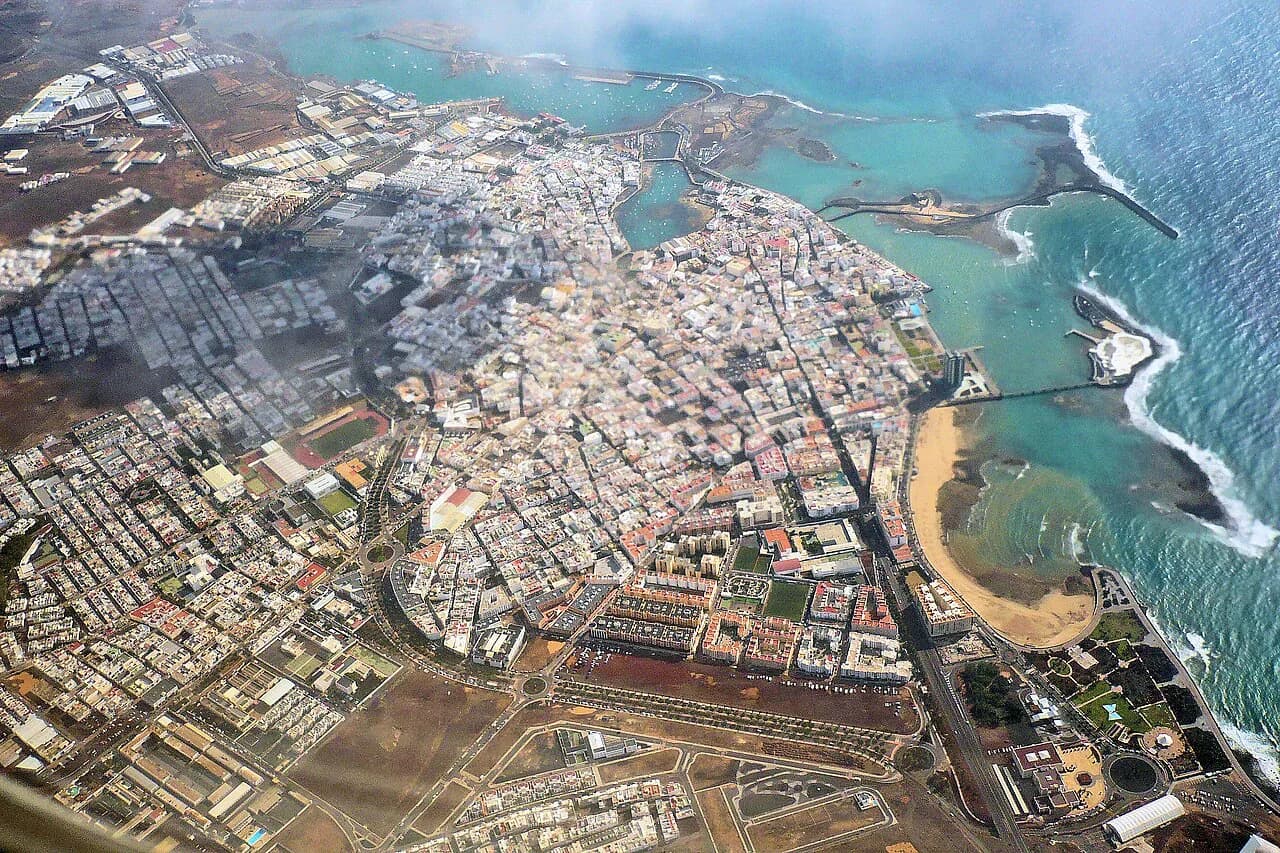
Arrecife is smaller on the ground than a capital-city label suggests: the historic centre sits immediately behind the working port, so the lagoon, the main shopping street and the sea are all within a short walk of each other. The two fortresses are the exception, because each stands on its own islet or cliff edge rather than in the street grid. This map-based guide groups the sights into four clusters, explains how they connect, and gives a walking order that keeps you facing forward along the waterfront.
Treat the town as a port capital rather than a monument city and the map makes more sense. Most of what you will want to see is coastal or just inland from the coast. Use the things to do in Arrecife guide for the full list of sights once you have the layout straight.
Arrecife in one look: a compact capital where the historic centre sits behind the port
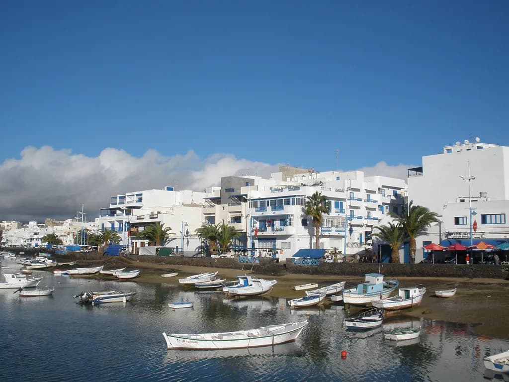
Arrecife grew as a fishing and trading harbour, and its oldest quarter still hugs the water rather than spreading inland. The Charco de San Ginés, a marine lagoon connected to the ocean by a narrow channel, forms the heart of that quarter, with white houses from the seventeenth to nineteenth centuries around its edge. Everything else in the centre radiates from there, which is why a map of Arrecife is really a map of its shoreline.
Four clusters cover a half day comfortably. First the Charco and its lanes, second the church and Calle León y Castillo, third the Castillo de San Gabriel and its stone bridge, and fourth the northern cliff with the Castillo de San José, with the seafront avenue and Playa del Reducto closing the line to the south. Reading the town this way stops you criss-crossing the centre.
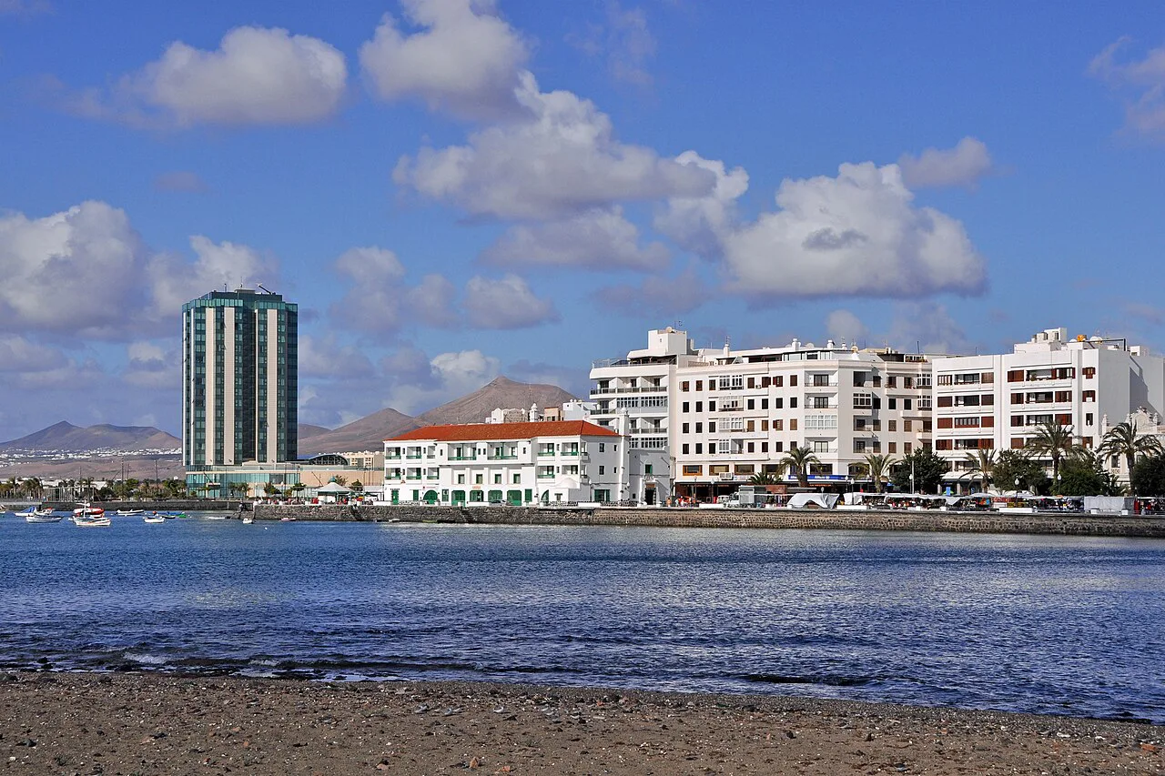
Start at the Charco de San Ginés, the lagoon at the heart of the old town
Begin at the Charco de San Ginés, a natural saltwater lagoon of about 1.2 hectares that was once the fishing harbour and is now ringed by low white houses and moored boats. It is the obvious place to fix your bearings because the town's main walking routes pass its edges, and the fishermen's houses around it are protected as a cultural asset.
From the lagoon, the Callejón El Aguaresío is a small paved passage linking the water to the parish church, with volcanic stone walls and a large ficus giving shade. It is short, so fold it into the walk rather than treating it as a separate stop.
Beside the Charco: the Iglesia de San Ginés and the lanes around it
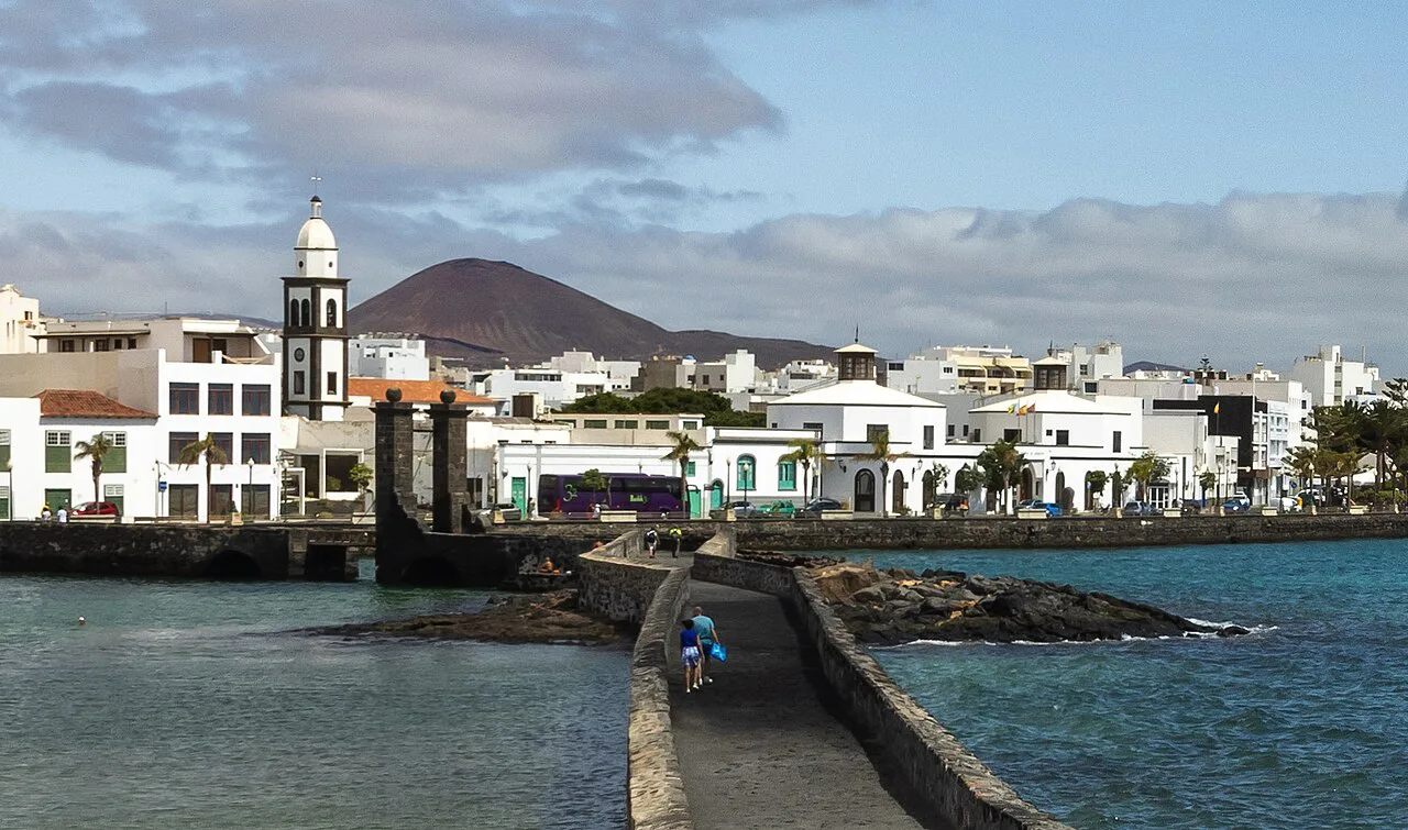
The Iglesia de San Ginés, also called the Parroquia de San Ginés, stands at the top of the old quarter beside the lagoon and is the landmark most locals use to describe the centre. Its plaza and the lanes feeding into it are where the old town feels most like a town rather than a port. The Arrecife old town page picks up the surrounding streets in more detail.
Two further landmarks sit in or near this cluster and are easy to add without lengthening the route much: the Casa Amarilla, a historic building used for cultural exhibitions, and the Parque José Ramírez Cerdá with its music kiosk. Both are stop-and-look points rather than destinations in their own right.
Calle León y Castillo: the old Calle Real through the commercial centre
Calle León y Castillo, the former Calle Real, runs through the commercial heart of Arrecife and is where the town's merchant houses and old warehouses meet present-day shops. It is pedestrianised, so it works as the spine of a walking route rather than a street you pass along in a car.
Use it as the inland link between the lagoon quarter and the port front, and you avoid retracing steps later in the day. Shopping in Arrecife covers the streets and malls if you want to build a longer browse into the walk.
Castillo de San Gabriel and the Puente de las Bolas
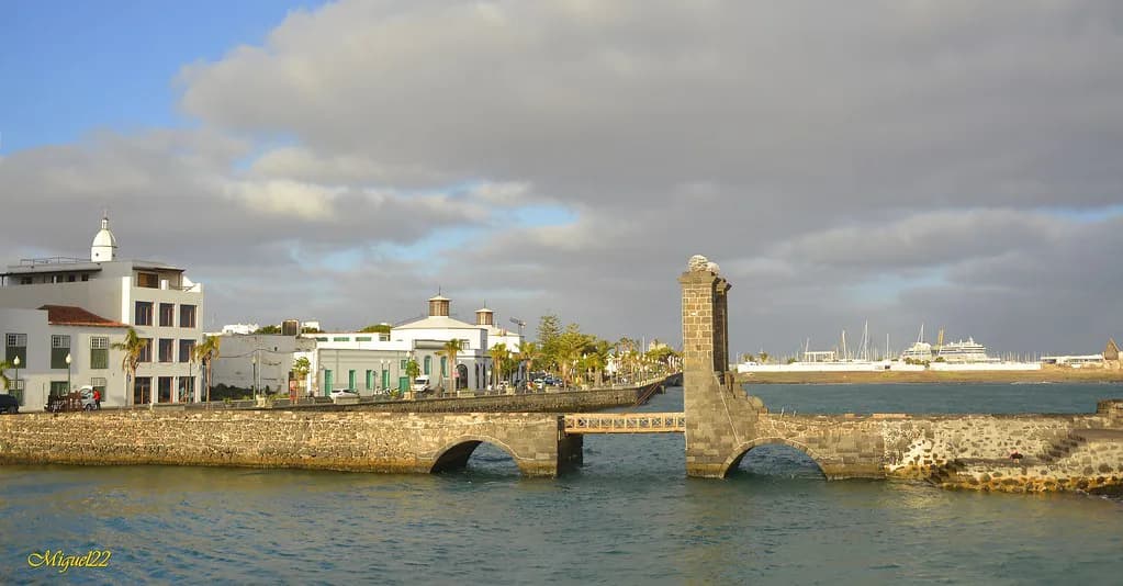
The Castillo de San Gabriel is the oldest defensive fortress in the city, raised in 1574 on a small islet just off the shore to guard the natural harbour against corsair and English raids. You reach it across the Puente de las Bolas, a stone footbridge finished with two spheres at its ends.
Inside, the fortress complex holds the local history museum, and the published general admission tariff is 3 EUR. Time your approach for early morning, when the tide is low and the volcanic reef profiles below the castle show clearly.
Castillo de San José and the MIAC on the cliffs above the Puerto de Naos
The Castillo de San José sits on the cliffs above the Puerto de Naos at the northern end of the waterfront, a circular bastion built in 1779 under Carlos III to create work during a famine, hence its nickname, the Fortress of Hunger. César Manrique converted it in 1976 into the Museo Internacional de Arte Contemporáneo, the MIAC, pairing modern art with military architecture.
This is the one stop on the map that sits above the town rather than beside it, so allow for the climb along the waterfront and treat it as the far end of the walk north. César Manrique's Houses in Lanzarote explains his other projects on the island if the conversion interests you.
The seafront: Marina Lanzarote, the Avenida Marítima and Playa del Reducto
Marina Lanzarote anchors the modern port area and connects smoothly to the broad Avenida Marítima, so the seafront reads as one continuous promenade from the marina past the historic fortresses. Playa del Reducto, the town's main urban beach, sits at the southern end, a stretch of some 480 metres of golden sand shielded from northern currents by a natural reef barrier.
On a map the beach is easiest to read as the closing landmark of the seafront rather than a detour, because you pass it on the way in or out of the centre. That keeps the walking route linear.
The four-kilometre waterfront walk that links the harbour to the castles
The seafront can be walked end to end from the marina to the defensive castles in a comfortable route of barely four kilometres, which is the single most useful line to draw on your map. It strings together the modern marina, the Avenida Marítima and the two fortresses without sending you back through the streets.
Walk it one way and return through Calle León y Castillo for a loop, rather than out and back along the same promenade. The inland street gives you the old commercial centre on the way home.
Getting your bearings on arrival: the town is a short hop from Lanzarote airport
Arrecife is the capital, and the island's airport is the natural arrival point for most trips. Plan the transfer with a current operator or the airport's own information, and head for the Charco de San Ginés on arrival, since it sits at the centre of everything else on this page.
If you are coming from elsewhere on the island, Teguise, Lanzarote's old capital inland, is the other historic town worth folding into the same trip. Teguise: what to see in Lanzarote's old capital covers what to see there.
A sensible walking order for half a day
Start at the Charco de San Ginés, take the Callejón El Aguaresío up to the Iglesia de San Ginés, then drop down through Calle León y Castillo towards the water. Cross the Puente de las Bolas to the Castillo de San Gabriel, then follow the Avenida Marítima north past Marina Lanzarote to the Castillo de San José and the MIAC. Keep Playa del Reducto for the southern stretch of the seafront, since it lies at the opposite end from the San José cliffs.
That order keeps the inland lanes for the morning, when the walking is coolest, and leaves the open waterfront for later. It also puts the paid interior stop early enough that you are not rushing it.
What the map will not tell you: heat, midday closures and the pace of a port capital
Arrecife is a working port capital, not a monument town, so the distances are short but the atmosphere is everyday rather than curated. Churches in the centre are working parishes, so a visit can be interrupted by mass; time indoor stops for the morning or late afternoon.
The waterfront is exposed, and the Canary Islands sun is strong at midday even with a breeze off the Atlantic. Carry water, and treat the shaded lanes of the old quarter as your natural break between the two castles.
Which end of the waterfront to start from
Start at the Charco de San Ginés if you want the historic centre first, and at Marina Lanzarote if you would rather walk the seafront into the old town. Either way, the two castles bookend the north–south waterfront, and the beach closes the southern leg while the lagoon closes the centre.
Draw those four clusters on your own map before you go: lagoon, church lanes, Calle León y Castillo, and the seafront with its fortresses. The rest of Arrecife is a port you can read at a glance.
Explore more Arrecife guides
Frequently Asked Questions
Is Lanzarote airport called Arrecife?
Lanzarote's airport is the island's own, and the capital it serves is Arrecife. Check the airport's own information for transfers rather than relying on a town map.
Can you walk between Arrecife's main sights?
Yes. The Charco de San Ginés, the church lanes, Calle León y Castillo and the seafront sit close together, and the waterfront route from the marina to the castles covers about four kilometres. The Castillo de San José sits higher above the Puerto de Naos, so allow for the climb.
Is the Castillo de San Gabriel inside the old town?
No. It stands on its own small islet off the shore and is reached across the Puente de las Bolas, which is why it reads as a separate point on a map rather than a street address. Check the current admission tariff before you cross.
Sources
Notes for your next Spanish town break
Optional updates to our guides.
You might also like
Continue reading
More guides you'll find useful