Burgos Map: Old Town, Cathedral and Main Sights by Area
A map-based guide to Burgos: how the cathedral, Arco de Santa María, castle hill and monasteries sit together, and how to plot a walking loop.
On this page
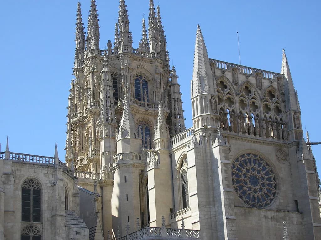
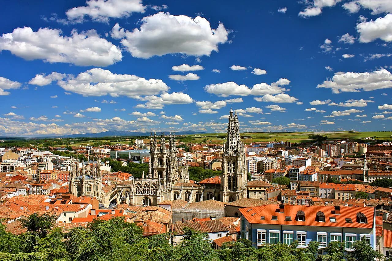
A Burgos map makes sense in one glance if you start with the cathedral: the Catedral de Burgos anchors the historic centre and almost everything else can be plotted by its direction from that block. The Arco de Santa María, the Plaza del Rey San Fernando, the Cid-era streets and castle hill all sit within the same compact core, so a single plotted loop beats scattergun trips across town. This guide groups the monuments by area and keeps the outlying sites separate.
Read the map in two layers. The first is the compact monumental centre, where the cathedral, gate, churches and civic buildings cluster tightly enough to see in one walk; the second is everything outside it, from the Cartuja de Miraflores to the castle hill above the streets. The castle hill sits within the monumental core rather than out in the suburbs, so keep it with the city layer and leave the Cartuja de Miraflores as the one clearly separate leg.
What a Burgos map shows you at a glance
Burgos is the capital of its province and sits in the Burgos y Alfoz district at the centre of the province, which explains why so many routes fan out from it. On a map the city reads as a tight knot of churches, gates and civic buildings rather than a spread-out grid, so the useful question is the order to take things in, not the distance between them. Start by marking the cathedral and the Arco de Santa María, then add the castle hill and the river.
The official provincial tourism site splits the city's sights into named groups rather than a single list, which is a better way to build a map: the cathedral and its gate, the Cid material, the castle, the monasteries and the individual parish churches each form their own cluster. On a short break, mark the cathedral cluster and the castle; with a full day, add the churches and the Casa del Cordón.
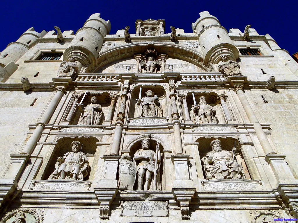
The cathedral block and what surrounds it
The Catedral de Burgos is the obvious first pin, and the Arco de Santa María sits in the same monumental grouping, so the two belong on the same leg of any route rather than at opposite ends of the day. The Plaza del Rey San Fernando is the open space beside the cathedral where that grouping reads most clearly on a map: gate, square and cathedral in one line. Pin all three before you plot anything else.
The cathedral anchors the old town's scale, so once you know where it stands you can place the Casa del Cordón, the parish churches and the Cid streets relative to it without much trouble. Treat that block as your origin point and the rest of the centre as spokes; a change of plan then costs you one leg of the loop, not the whole day.
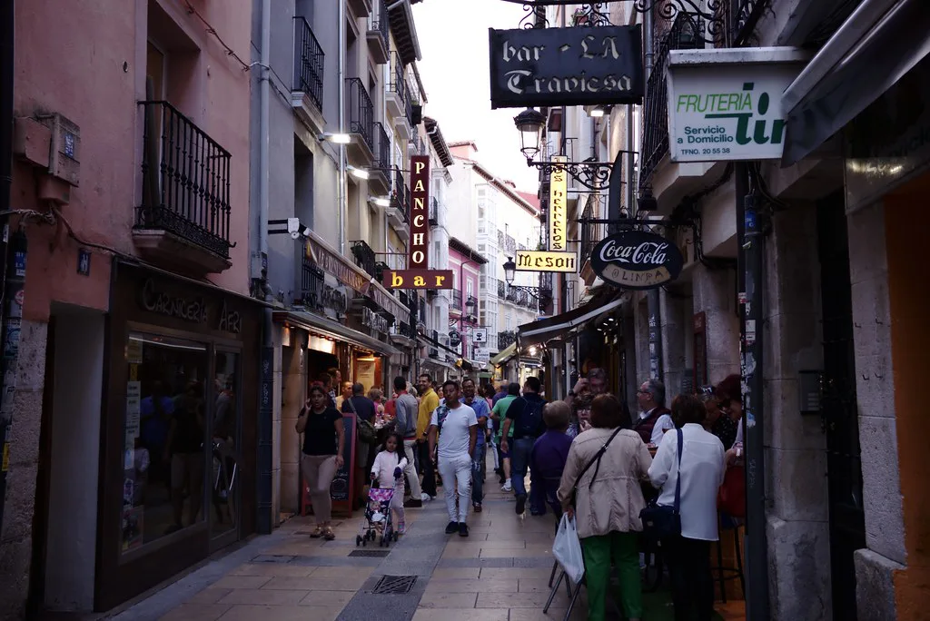
Burgos Cidiano: the streets tied to El Cid
Burgos is closely associated with El Cid, and the provincial tourism list gives the Cid material its own route, separate from the cathedral grouping. On a map that means a second cluster of streets and monuments sitting alongside, not inside, the cathedral block. Plot it immediately after the cathedral so the two connect on foot, and use the Cid route as a way of linking other sights rather than as a destination in itself.
What matters on your map is that the Cid streets sit next to the cathedral on the loop, not that you follow someone else's sequence. Sketch the order once, check it against the city's sight groups, and then stop planning.
Castle hill and the view over the city
The Castillo de Burgos belongs on the map as an elevated point above the historic centre, not as another building in the cathedral cluster. Plotting it last in a walking loop makes practical sense: it sits at the edge of the monumental core, and the raised ground gives you the view back over the city you have just walked through. Mark it as a terminus, not a starting point.
The uphill position is the trade-off. On a short break it costs time and effort, so decide early whether the view matters more to you than an extra church. If it does, take the castle last and let the descent carry you back towards the centre; if you would rather keep the day flat, leave it for a return visit.
The river and the promenade
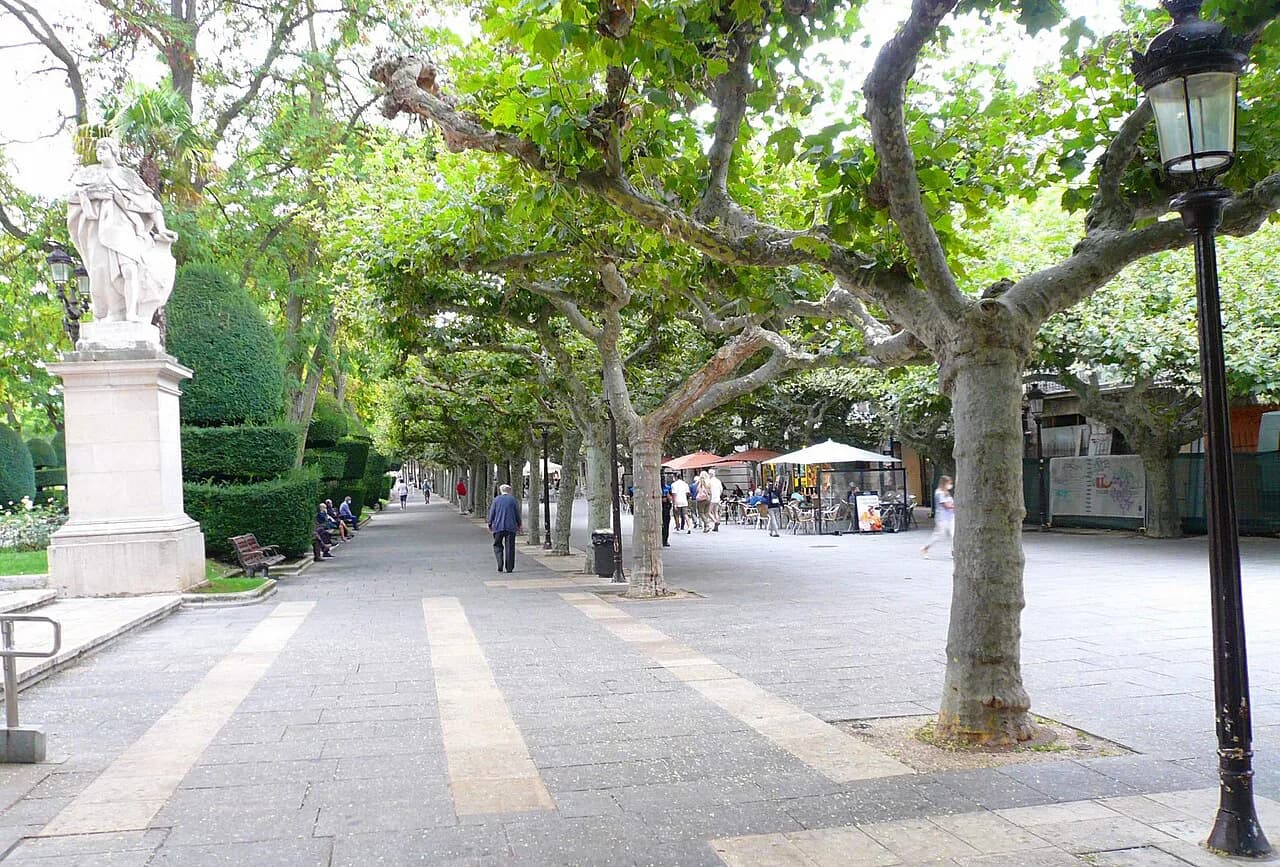
The Arlanzón gives the city a line to follow, and the riverside promenade works on a map as the boundary between the older streets and the newer ones. Mark the river alongside the cathedral and the Cid streets: it tells you which direction the centre opens out and gives you a natural route back from the edge of the old town.
A river on one side and a castle hill on the other give you two natural anchors, so you can sketch a rough circuit without memorising a street grid. That rough circuit is enough for a city this compact; refine the details only if something forces a change.
Churches and monasteries to plot beyond the centre
The provincial tourism list names the Cartuja de Miraflores, the Monasterio de San Juan, the Iglesia de San Esteban with its Museo del Retablo, the Iglesia de San Gil and the Iglesia de San Nicolás de Bari as separate stops, so mark each one individually rather than lumping them together as churches. The Cartuja de Miraflores is the clear outlier: it sits apart from the historic centre, so give it its own leg of the day rather than tacking it onto a cathedral loop.
The Iglesia de San Esteban houses the Museo del Retablo, which makes it a different proposition from a quick look at a parish church. If your map has a short-list of churches and you want to choose, favour San Esteban for the museum stop and keep San Gil and San Nicolás de Bari for a simpler architectural round.
Outside the city, the provincial guides list Santo Domingo de Silos as its own destination, which is useful context: a traveller who wants a monastic day should decide whether to spend it in Burgos or on the road to Silos. Marking both on your map makes that choice obvious.
Casa del Cordón and the civic buildings
The Casa del Cordón is listed alongside the Arco de Santa María and the cathedral as part of the city's monumental core, so it belongs on the same short leg of the loop as the gate and the square. Plotting the civil buildings with the religious ones keeps the plan realistic: the walk between them is short, and changing from one to the next costs no travel time.
The Casa del Cordón also works as an orientation point on the map itself: once you have found it, the cathedral, the gate and the riverside streets fall into place around it. If you are in Burgos for a single evening, this cluster is where to spend it rather than the churches further out.
Using the map to plan a walking loop
A workable loop starts at the cathedral and the Arco de Santa María, moves through the Cid streets and the Casa del Cordón, and finishes with castle hill and the river. Keep to one direction rather than doubling back, so each stop follows the last on the map instead of dragging you across town. The compactness is the advantage: the loop is defined by order, not by distance.
Leave the outlying Cartuja de Miraflores and the provincial towns for a second leg or a second morning, and treat that as a separate map with its own single destination. Mixing the city loop and an outlying monastery into one day is where a Burgos itinerary starts to feel rushed. Mark the split on paper before you go.
The wider list of things to do in Burgos is a good place to test the order of your loop before you walk it, because it groups the same places you have been plotting. Compare your route with it, adjust the order once, and then stop planning.
The Camino de Santiago through the city
The Camino de Santiago – Camino Francés runs through Burgos, and on a map it reads as a line crossing the city rather than a single sight to pin. That makes it useful as an orientation device: knowing roughly where it passes makes the position of the old town easier to read.
For a city break, ignore the stages and use the Camino as one more line on the map, alongside the river and the castle hill. If you are walking a stage into or out of Burgos, treat the crossing as part of your day rather than an extra attraction, and adjust the loop accordingly.
Towns in the province worth marking on a wider map
Beyond the city, the provincial guides list Atapuerca, Covarrubias, Lerma, Santo Domingo de Silos and Frías as destinations in their own right, each with its own heritage set. On a longer trip, mark them on a wider map and treat them as separate outings rather than an extension of the city loop.
Each town has a distinct cluster: Covarrubias with its walls and Excolegiata de San Cosme y San Damián, Lerma with its Palacio Ducal and convents, Frías with its castle and Casas Colgadas, and Silos with its Monasterio Santo Domingo. On a wider map they fan out around Burgos, so choose which direction to travel first rather than trying to link several in one day.
Which layer of the map do you need?
Most visitors only need the inner layer: cathedral, Arco de Santa María, the Cid streets, the Casa del Cordón and the churches, with castle hill and the river as the frame. With more time, add the outlying Cartuja de Miraflores as its own leg and leave the provincial towns for a longer stay.
Plot the loop in one direction, keep the outlying stops separate, and your Burgos plan will hold up even when something on the day changes. The city is compact enough that map order matters far more than walking speed.
Frequently Asked Questions
In which country is Burgos located?
Burgos is in Spain, the capital of the province of Burgos in the region of Castilla y León. It sits in the Burgos y Alfoz district at the centre of the province.
Why is Burgos famous?
Burgos is best known for its cathedral, for its associations with El Cid, and for its position on the Camino Francés. The provincial tourism list also gives prominence to the Arco de Santa María, the castle and the city's monasteries and parish churches.
How should I organise the sights on a Burgos map?
Start with the cathedral and the Arco de Santa María, then the Cid streets and the Casa del Cordón, and finish with castle hill and the river. Keep the outlying Cartuja de Miraflores and the provincial towns for a separate leg of the trip.
Sources
Notes for your next Spanish town break
Optional updates to our guides.
You might also like
Continue reading
More guides you'll find useful