Toledo Map: Where the Old Town Sights Sit
Use this Toledo map guide to place the old town, the Alcázar, the cathedral and the main sights on foot, and to see where the stations sit beyond the walls.
On this page
A Toledo map is most useful for one decision: which order to take the sights in, because almost everything sits inside one compact walled core on a hill, with the river looping round it and the station outside. Group the monuments by area rather than by a flat list, and you save both the climbs and the backtracking. This guide lays out the old town by cluster, from Plaza de Zocodover and the Arco de la Sangre up to the Alcázar and cathedral, across the Judería, and down to San Juan de los Reyes and the Mirador del Valle.
What a Toledo map shows you
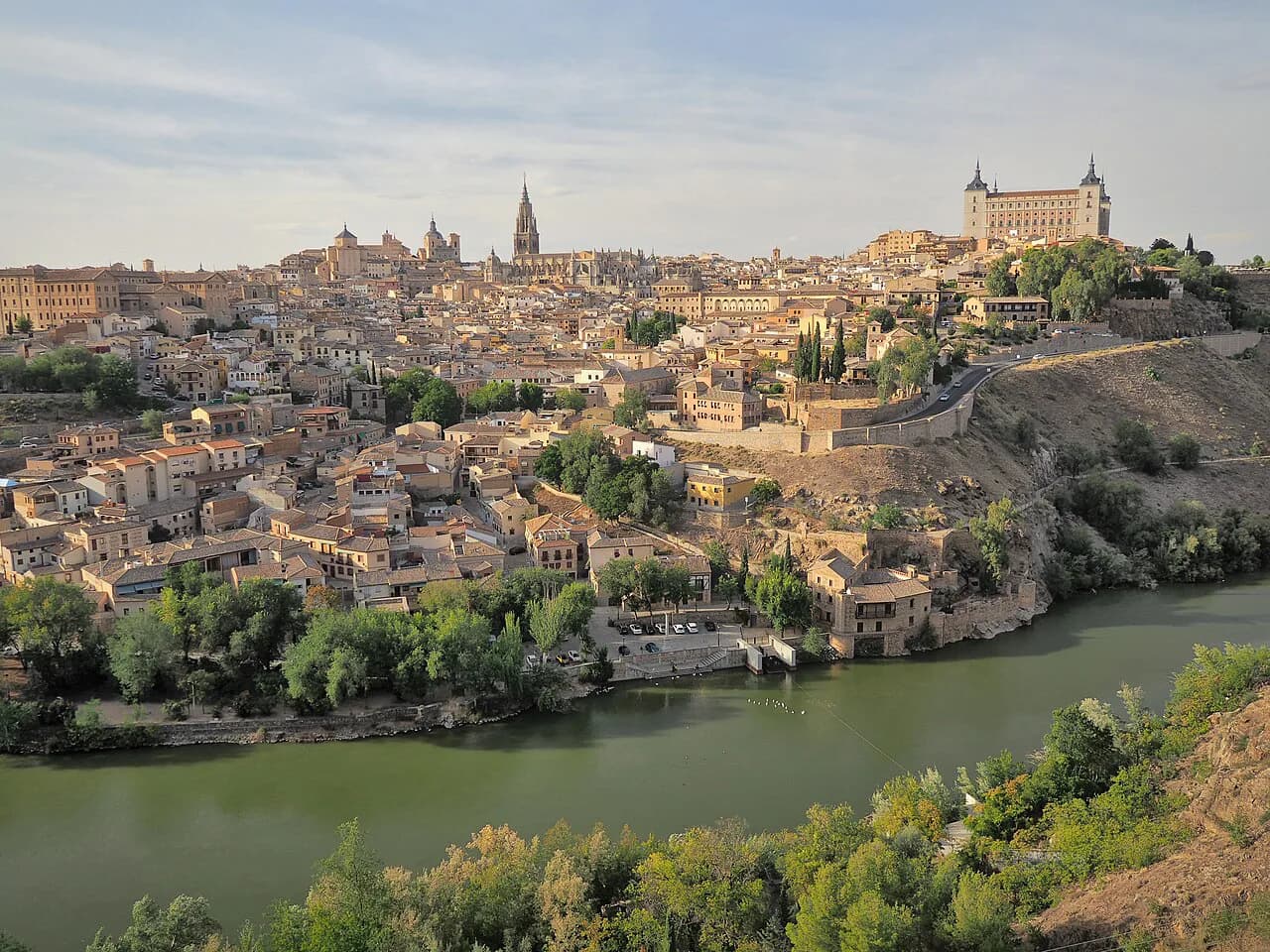
Toledo is an old town packed onto a hill inside a bend of the Tajo, so the printed shape of the city is a knot of lanes inside a wall with green space and water on three sides. A downloadable tourist map is the practical starting point, and one is offered as a PDF by a local guiding company alongside links to the bus station and the AVE arrival point. Download that kind of plan before you travel and mark your shortlist on it, because street signage inside the lanes is easier to follow if you already know which gate you entered by.
What the map will not tell you is ticket prices or visiting times, and those are the details that break a plan. Treat the plan as a shape, then confirm the ticket and time on the monument's own page or at the door. That way a closed church or a long queue changes your order, not your day.
The two entry points: Plaza de Zocodover and the Arco de la Sangre
Most walking routes into the old town converge on Plaza de Zocodover, the historic square that has hosted markets, celebrations and bullfights over the centuries and is now ringed by bars and shops. Just off it stands the Arco de la Sangre, a tenth-century gateway that was one of the main entrances to the city, with the Monumento a Cervantes right beside it. Start here and you can orientate without climbing, then choose whether to head up or across.
If you arrive on the Puerta Nueva de Bisagra side, the old town opens up gradually and Zocodover comes as the natural first landmark rather than a detour. Plan your first hour around this square so that latecomers can find you, and keep the gateway as a meeting point rather than a sight to rush.
The upper core: the Alcázar and the cathedral
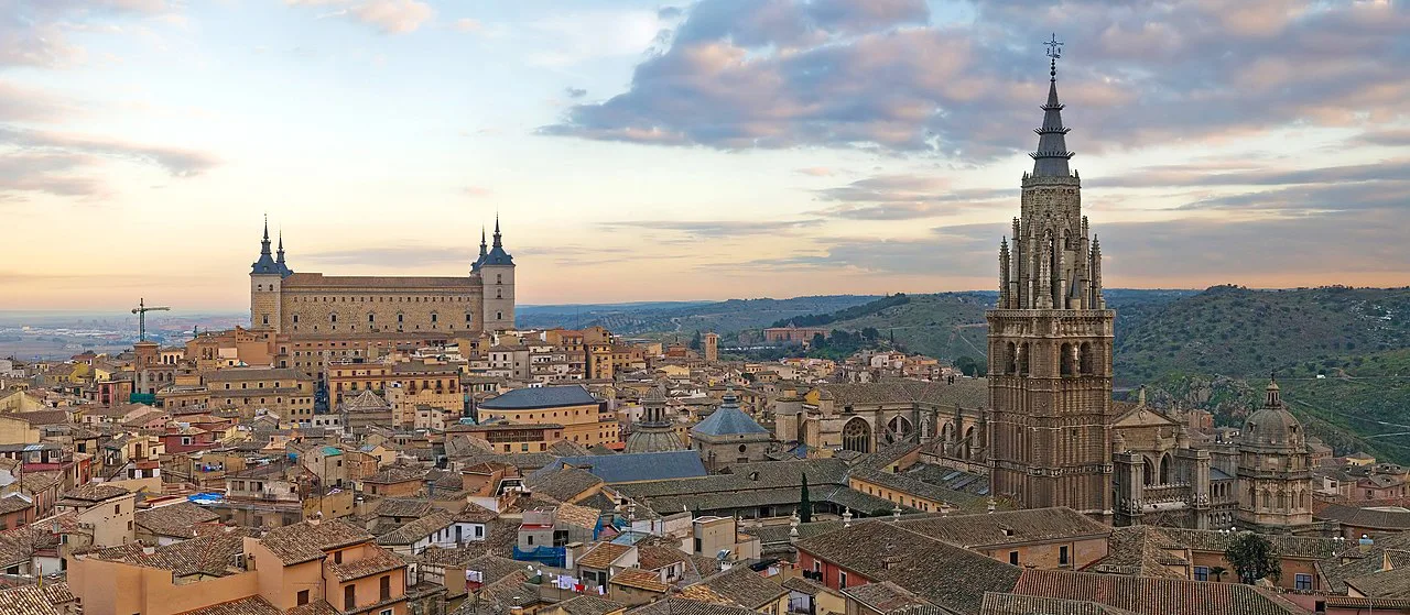
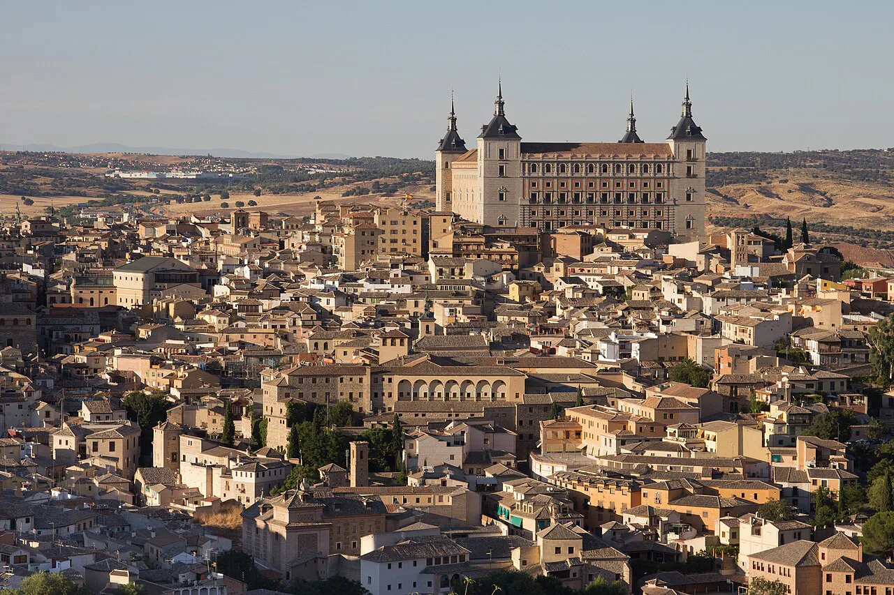
Above Zocodover the map shows the two heavyweight anchors close together: the Alcázar, the fortress on the high point that has served as palace and military base and now houses the Museo del Ejército and the city library, and the Catedral de Toledo, the Primate Cathedral of Spain. The climb between them is short in distance but steady in gradient, so put them at the start of the day rather than the end. Buy or reserve cathedral entry before you go if you want to avoid reshaping the morning around a queue.
Churches here keep their own rhythms, and a cathedral can close its doors to visitors while mass is being said, so a plan that treats it as always open will misfire. Check the day's visitor times before you commit the morning to it.
The Judería cluster: Santo Tomé, Santa María la Blanca and the Sinagoga del Tránsito
South-west of the cathedral the lanes tighten into the Judería, and here three sights sit within a short walk of each other: the Iglesia de Santo Tomé, which holds El Greco's El entierro del señor de Orgaz, the Sinagoga de Santa María la Blanca, one of the few medieval synagogues surviving anywhere, and the Sinagoga del Tránsito. A guided monumental route pairs these with the Mezquita del Cristo de la Luz, a tenth-century former Muslim oratory with nine domes of differing design, and the Real Colegio de Doncellas Nobles. Booking that route costs 20 EUR, or 12 EUR if you already hold the tourist wristband.
Walking this cluster yourself is easy on the map but slow in practice, because the lanes bend and the pavements narrow. Pick two of the three and give them proper time rather than racing all of them before lunch.
The lower edge: San Juan de los Reyes and the Mirador del Valle
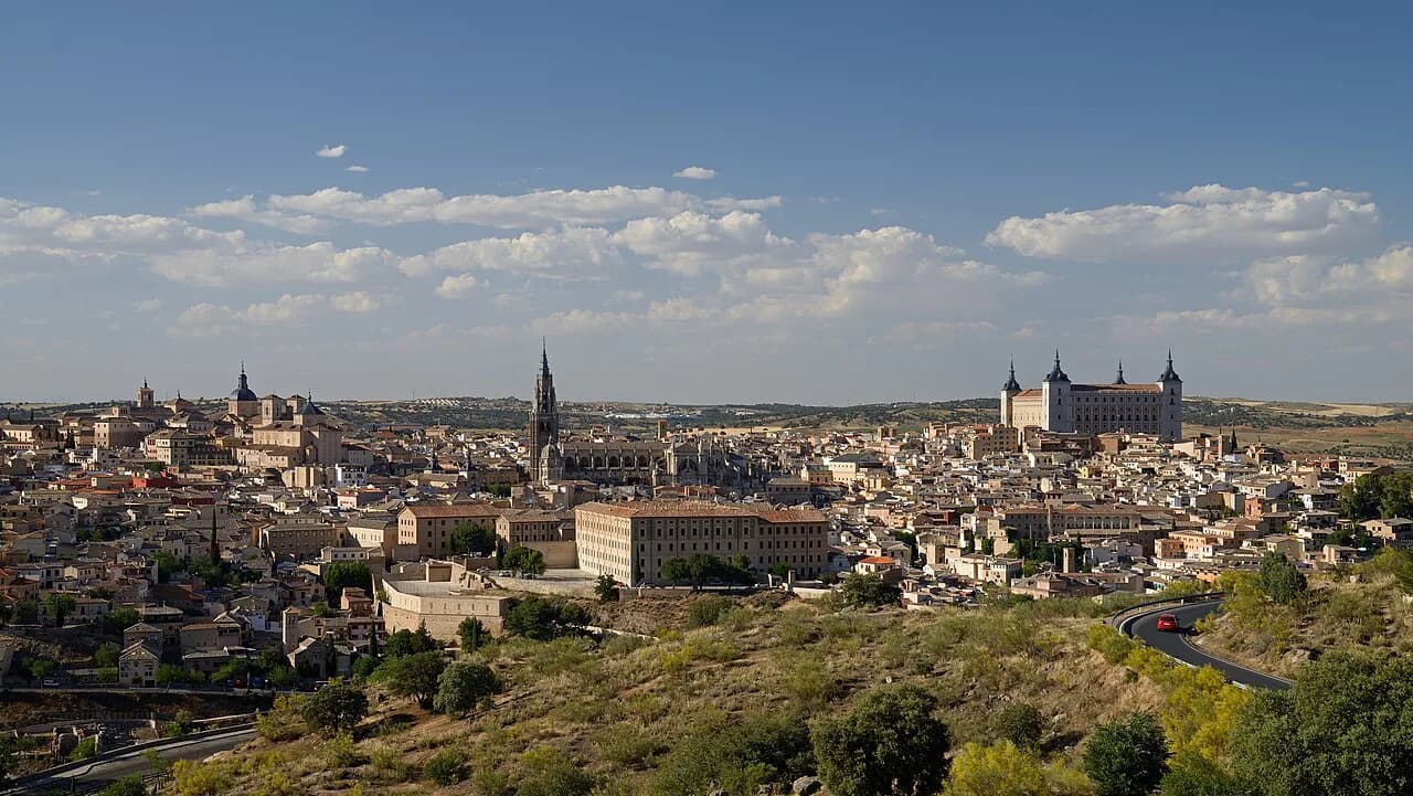
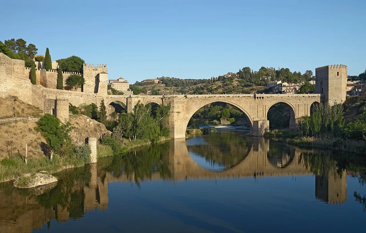
At the bottom of the old town the Monasterio de San Juan de los Reyes, a late-Gothic foundation of the Catholic Monarchs, marks the edge of the built-up core, and from there the map shows the river and a road climbing to viewpoints on the far bank. The Mirador del Valle is the classic panorama across the gorge, and it is the one point on the plan that sits outside the walls. Budget the crossing and the climb as a separate outing rather than tagging it onto a cathedral morning.
If your legs are finished by late afternoon, the view is the item to drop, not the monastery. Reversing that order costs you the easy downhill finish.
Laying the monuments out on foot and the order that saves the climbs
Read the map as three tiers and work downhill: Zocodover and the Arco de la Sangre first, the Alcázar and cathedral on the high ground next, the Judería after that, and San Juan de los Reyes plus the river crossing to close. That sequence trades a handful of short ascents for one long one, which matters more than total distance in a hill town of this size. Further ideas are set out in this guide to things to do in Toledo, while a walking tour with a guide suits anyone who would rather be led than navigate.
Plan the museum stops deliberately too, since a couple of them add a dry, seated hour in the middle of the day. The city's collections are grouped in this guide to museums in Toledo, and choosing one in advance keeps you from drifting into a third monument when your feet have had enough.
Train and bus arrival points and the climb to the old town
On the map the station and the bus interchange sit outside the historic core, below the hill, and the last stretch to Zocodover is uphill. That gap, not the spacing between monuments, is the real planning constraint on a short break. A PDF plan issued by a local guiding company links to both the bus station and the AVE arrival point, and those are the links to use when you work out the final approach.
If you are carrying luggage or travelling with someone who tires quickly, take local transport up the hill and walk down at the end of the day. It is a small decision that preserves the hours you came for.
Parking and driving near the historic centre
Driving into the walled core is not the plan: the lanes are narrow, the ground is steep and a car is a liability once you are inside. Leave the vehicle outside the old town and finish on foot or by local bus. A tourist plan published by a local guiding company points you to the bus station and the AVE arrival point, which is the level of detail to look for rather than turning up and hunting for a space.
Confirm restricted zones and parking charges with the operator or the town hall before you drive, and treat any barrier or sign you meet on the day as final.
Paid entry versus the seven-monument wristband
The clearest cost decision on the map is whether to pay per door or buy the Pulsera Turística de Toledo. The wristband covers seven monuments for 12 EUR, against individual entry of 4 EUR at each, which the operator presents as a saving of 16 EUR; the guided monumental route then costs 20 EUR, or 12 EUR for holders of the wristband. Count the doors you genuinely plan to enter before buying, because the wristband only pays off past three stops.
Those figures come from a local operator and are changeable, so confirm the current rate when you buy rather than relying on a figure read months earlier. Tickets for the cathedral and the Alcázar museum are separate purchases from the wristband.
When the map is useless: heat, siesta hours and Monday closures
A paper plan cannot show the two things that undo an inland Castilian day: midday heat in summer and the habit of churches and small shops closing for a long lunch. Build the day so the high ground is walked in the morning, keep a museum or a long lunch for the hottest hours, and return to the lanes in the late afternoon.
Monday is the other trap, since some sights and many shops take it as a closing day. Check each monument's own published times for the day you are going rather than assuming the whole city runs to one timetable.
Number your sights from the top of the map down
Print or download a Toledo plan, mark Zocodover, the Alcázar, the cathedral, the Judería trio, San Juan de los Reyes and the Mirador del Valle, then number them downhill. Decide on the wristband once you know how many doors you will actually enter, and leave the station climb for the start rather than the end. The wider set of monument guides for the city sits alongside this one if you want to plan door by door.
Explore more Toledo guides
Frequently Asked Questions
Is Toledo in Spain or the United States?
Both names exist. This guide covers Toledo in Spain, the walled city on a hill inside a bend of the Tajo, south-west of Madrid. The Toledo in Ohio is a separate city and has no bearing on this plan.
Where do I get a map of Toledo's old town?
A downloadable tourist plan in PDF format is offered by a local guiding company, and it includes links to the bus station and the AVE arrival point. Pick one up before you travel and mark your shortlist, since the lanes are easier to follow when you already know your entry gate.
Sources
Notes for your next Spanish town break
Optional updates to our guides.
You might also like
Continue reading
More guides you'll find useful