A Coruña Map: Old Town, Seafront and the Tower of Hercules
A visitor's map of A Coruña: the Ciudad Vieja, María Pita, the seafront promenade and the Torre de Hércules, with what sits where and the walks between them.
On this page
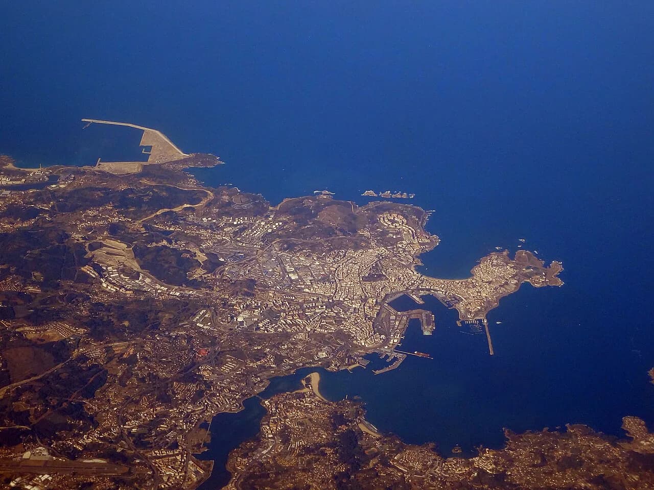
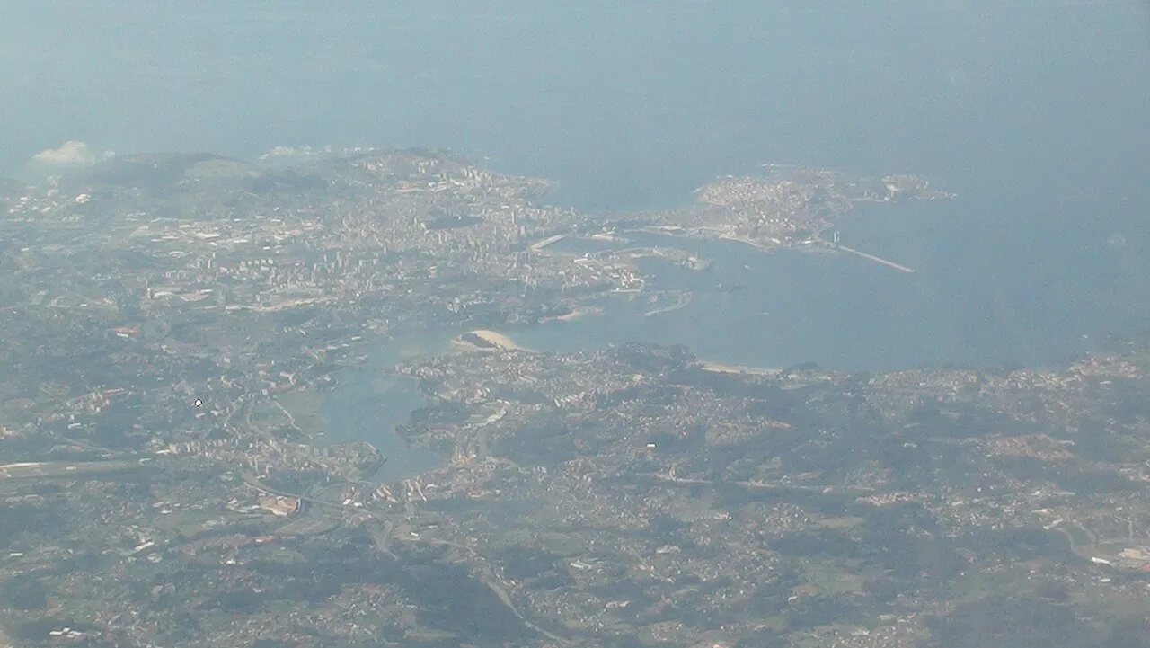
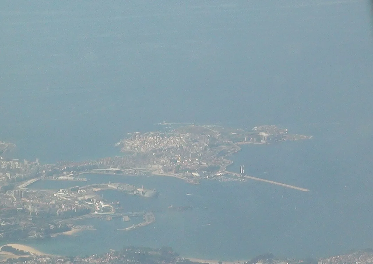
Think of A Coruña as a peninsula with two faces: the walled Ciudad Vieja and the harbour on the east side, and the open Atlantic along the western seafront. The city's sights line up along that spine, so a map of A Coruña makes most sense read as a single route from the old town to the Torre de Hércules rather than as scattered pins. This guide groups the main places by area, explains what connects them, and shows how to shape a half-day or a full day in map order.
The key trade-off is distance at the western end. The Torre de Hércules sits beyond the built-up seafront, past the Ensenada de San Amaro and the green spaces at Punta Herminia, so starting at the harbour means a long walk out or a deliberate decision to begin at the tower and work back. Planning around that one fact saves more time than any list of monuments.
What a map of A Coruña shows at a glance
The historic centre occupies the eastern tip of the peninsula, with the harbour and the marina of La Marina on its southern flank. West of the old town, the Plaza de María Pita acts as the hinge to the modern grid of streets, and beyond that the city opens onto the Paseo Marítimo. The Torre de Hércules anchors the far western end, on its own headland.
Read in that order, the map gives you three zones: the Ciudad Vieja and María Pita, the modernist centre around Calle Real and the Jardines de Méndez Núñez, and the coastal strip running out to the tower. Grouping your day by zone keeps you from criss-crossing the peninsula, which is the main way a short break in A Coruña loses hours.
The Ciudad Vieja: the walled core and its plazas
The Ciudad Vieja is compact enough to cover on foot, and its interest lies in the plazas and the lanes that join them rather than in any single address. Approach it from the harbour side and you enter through the old street pattern, with the Plaza de María Pita immediately to the south-east as the natural gateway. Give the core a proper block of time rather than treating it as a passage to somewhere else.
Because the old town sits at one end of the peninsula, it works best as the start of a walking day: finish the core, cross María Pita, and head west without doubling back. If you only have an afternoon, this is the zone to protect, since the seafront beyond it is long and open rather than dense with sights.
Plaza de María Pita and Calle Real: the hinge of the city
The Plaza de María Pita is the seam between the old town and the modern city, a wide open square that tells you where one district ends and the next begins. From it, Calle Real runs inland as the commercial spine of the centre, linking the historic core to the streets around the Jardines de Méndez Núñez and the Palacio de la Ópera. Treat the square as your map's reference point: most of the centre is described in relation to it.
This is also where the map's character changes. East of María Pita you are reading lanes and plazas; west of it you are reading broad streets and a grid, which is faster to walk and easier to navigate when you are short of time.
The modernist quarter and the Paseo Marítimo
A Coruña's modernista architecture is one of the reasons the centre rewards a slower pass, and the route is set out in the city's own leaflets rather than left to guesswork. The Palacio de la Ópera and the Jardines de Méndez Núñez sit in this middle band, giving you a natural pause between the old town and the coast. From here the Paseo Marítimo begins its run along the water towards the western headlands.
On the map, the promenade is the line that holds the whole visit together: it connects the harbour area to the Ensenada de San Amaro and onward to the tower. Once you understand that, you can decide whether to walk it in one direction or split it across two days, which is the honest choice if you also want time in the museums and churches.
The Torre de Hércules and its sculpture park
The Torre de Hércules is the far western point of the peninsula and the reason many people come, and it is a UNESCO World Heritage site with its own dedicated leaflet in the city's tourism listings. Around it, the Parque Escultórico de la Torre de Hércules spreads sculpture across the headland, so the site is an area to walk rather than a single monument to tick off. Allow for that when you place it on your map.
The practical consequence is that the tower is a destination, not a passing stop. If your accommodation or your arrival point is at the harbour end, put the tower last and let the promenade carry you out; if you want it early and quiet, reverse the route and walk back into the centre.
Green space along the way
Three green areas punctuate the route and give it shape. The Parque de Santa Margarita lies inland and suits a separate loop rather than the coastal line, while the Jardines de Méndez Núñez sit conveniently in the middle band near the opera house. The Parque de A Mariña, close to the old town, is the easiest breathing space to add on the way in or out of the Ciudad Vieja.
Each of these changes the pace of a day rather than adding a sight. If you are walking the promenade out to the tower in summer, the inland parks are better saved for a cooler hour, and the coastal headland at Punta Herminia and Monte de San Pedro gives you open ground with a view back over the city.
Reading the official tourist map before you go
The A Coruña Tourist Board publishes its tourism brochures and guides through visitcoruna.com, and the list includes a touristic map alongside leaflets for the Torre de Hércules, the sculpture park, the old city route, the modernist route and the Picasso route. Downloading the ones that match your interests before you travel means you arrive with the routes already in your pocket.
The same page carries the Tower of Hercules Nature Area leaflet in Galician, Spanish and English, so check which language edition you are opening before you print anything. Opening times and admission details for the tower are set by the monument itself rather than by the brochure list, so confirm them on arrival or through the tower's own information before you build a day around a visit.
Laying the sights out as a walking route
A sensible map order runs from the Ciudad Vieja through the Plaza de María Pita, west along Calle Real to the Jardines de Méndez Núñez and the Palacio de la Ópera, then out along the Paseo Marítimo past the Ensenada de San Amaro to the Torre de Hércules. That sequence follows the peninsula without backtracking and keeps the longest stretch, the coastal one, at the end when you have already seen the dense part.
Two adjustments are worth making. First, decide in advance whether the inland parks are part of the day or a separate outing, since the Parque de Santa Margarita pulls you away from the coastal line. Second, if the walk out to the tower feels too long, use public transport for that leg and walk back, which preserves the seafront views in the direction that shows them best.
A half-day and a full day in map order
For a half-day, take the Ciudad Vieja and the Plaza de María Pita, add the Jardines de Méndez Núñez and the opera house on the way west, and stop before the coast. That covers the dense, walkable part of the map and leaves the promenade and the tower for another session rather than squeezing them in.
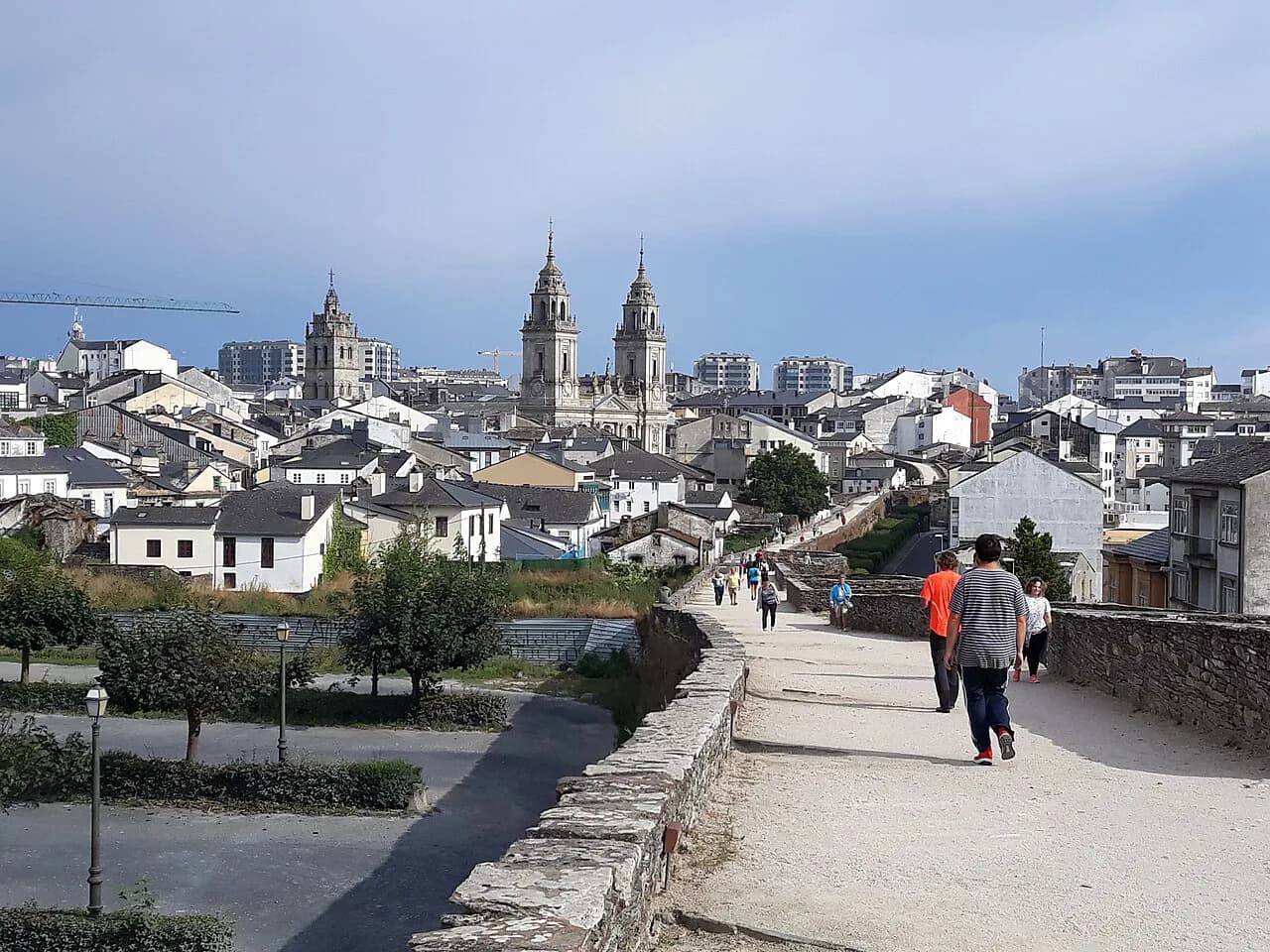
With a full day, start in the old town, follow the centre west through Calle Real, and then commit to the promenade out to the Torre de Hércules and its sculpture park, returning by bus or taxi if the walk back holds no appeal. If the city is your base for several days, it pairs naturally with inland Galicia, where the Lugo Roman walls make a contrasting day out.
Which end of the map do you start from?
Start at the Ciudad Vieja if you want the dense, historic half of A Coruña before your legs tire, and accept that the Torre de Hércules will come at the end of a long coastal walk. Start at the tower if you want the headland early and quiet, then work back through the promenade and the centre in reverse.
Whichever way you go, download the touristic map and the relevant route leaflets from the tourist board first, and treat the promenade as the line that joins the two halves of the city rather than an optional extra.
Explore more A Coruña guides
Frequently Asked Questions
Which airlines fly to A Coruña?
Check the airline and airport websites for current routes, since carriers change their schedules by season. The city's own tourism site covers getting there alongside its travel guides and brochures.
Is A Coruña worth visiting?
A Coruña packs a walled old town, a modernist centre, a seafront promenade and a UNESCO-listed Roman lighthouse into one peninsula, which is a lot for a short break. Whether it suits you depends on how much walking you want between the old town and the tower.
Sources
Notes for your next Spanish town break
Optional updates to our guides.
You might also like

Continue reading
More guides you'll find useful