Anaga Rural Park: How to Visit, What to See and How to Get There
Plan a visit to Anaga Rural Park in Tenerife: driving the TF-12 to Cruz del Carmen, the laurisilva forest, coastal villages and beaches.
On this page
Anaga Rural Park is Tenerife's green north-east: a UNESCO Biosphere Reserve of laurel forest, volcanic ridges and tiny hamlets, best treated as a half-day to full-day outing from Santa Cruz or La Laguna. You need a car to see it properly, an early start for parking, and a willingness to share narrow, twisting roads with cloud. This guide covers the two entrances, the TF-12 loop through the park, the Cruz del Carmen visitor centre, the laurisilva, the miradors and the north-coast villages of Taganana, Almáciga and Benijo.
What Anaga Rural Park is
The park covers much of the Anaga massif, the oldest-formed land on Tenerife, and extends across the municipalities of Santa Cruz de Tenerife, San Cristóbal de La Laguna and Tegueste. UNESCO recognised the area as a Biosphere Reserve, and the designation reflects both the ecological value of its forests and the terraced, inhabited landscape that has shaped the massif over centuries.
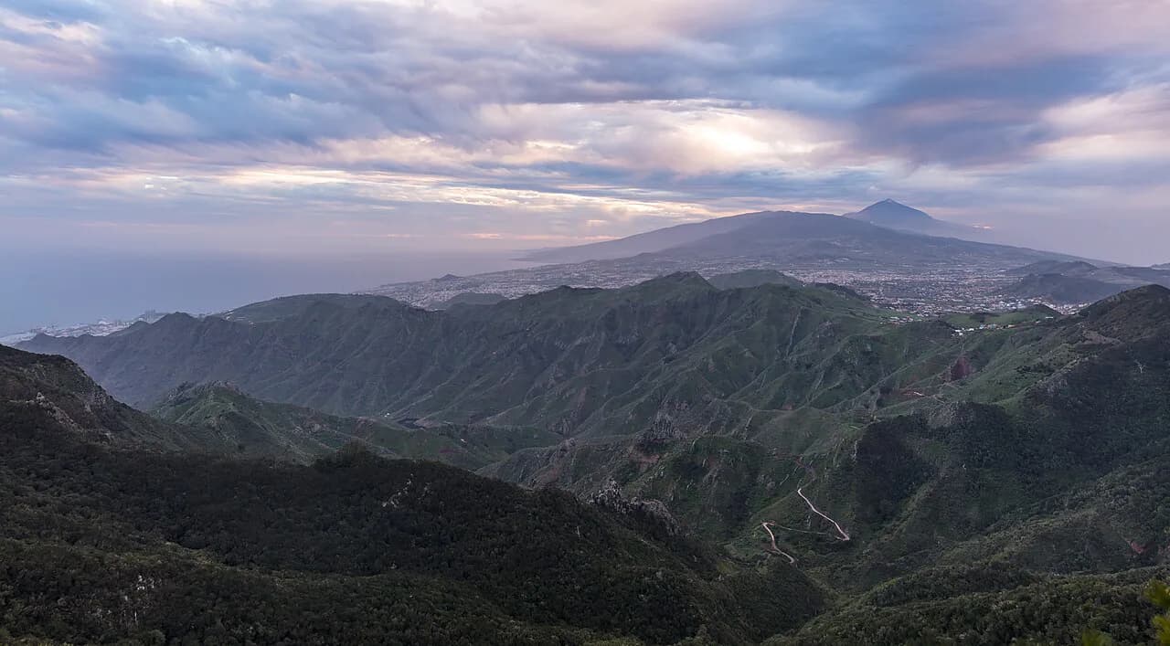
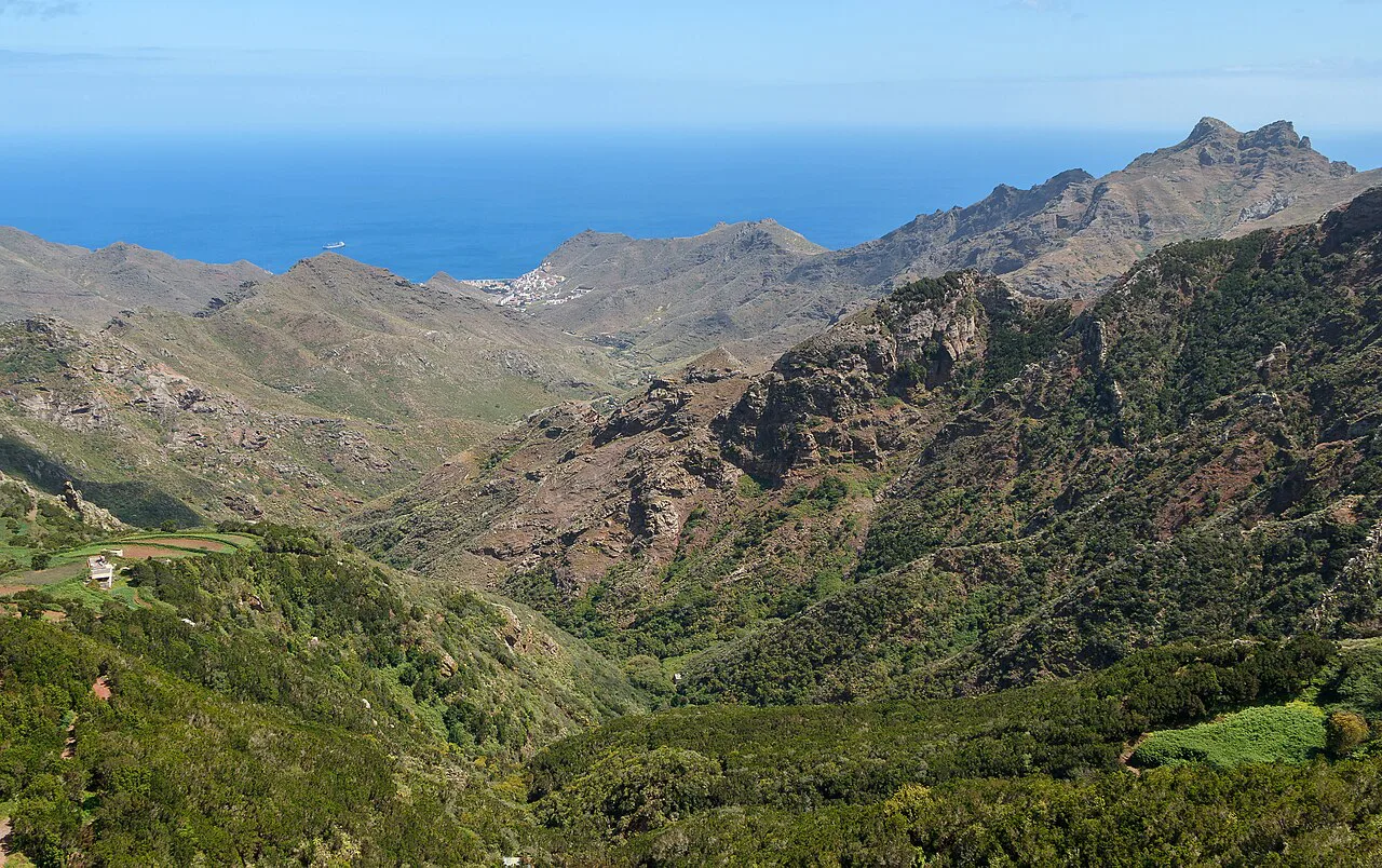
The relief is the point: sharp crests, deep barrancos running down to the Atlantic and volcanic roques standing above the tree line. Altitude, orientation and the trade winds create several distinct habitats in a small area, from coastal scrub to humid laurel forest. The old massif is also the reason the roads bend as they do, following ridges and barranco sides rather than cutting through them.
Where Anaga sits in Tenerife
Anaga occupies the north-east corner of the island, on the doorstep of both Santa Cruz and La Laguna, which makes it the easiest big-hitter day out from the capital. It is the opposite of the dry south around the resort coast: green, humid and frequently under cloud, with a climate driven by the trade winds rather than by shelter from them.
That contrast shapes how you plan the day. Come from the capital and you gain altitude into forest within a short drive; come from the southern resorts and Anaga becomes a full-day excursion across the island. If your base is the north, the park sits comfortably alongside the colonial streets of La Laguna, a UNESCO-listed town in its own right.
How to get there from Santa Cruz and La Laguna
There are two practical entrances to the circuit. The usual approach starts from San Cristóbal de La Laguna, where the road climbs into the park, and the alternative begins from the Playa de Las Teresitas side of Santa Cruz. Most visitors come in from La Laguna and drive the loop clockwise, which brings the Cruz del Carmen visitor centre early in the drive and lets you pick up a park map before the narrowest sections.
The TF-12 is the spine of the visit, a circular route with signed detours down to viewpoints and villages. Treat it as a loop rather than a there-and-back road: the spurs to the coast, and in particular the descent towards Taganana and the beaches, are the parts that reward the extra driving.
Driving in Anaga
The road climbs and falls through barrancos with near-continuous bends, and the far end of the circuit narrows further, with blind corners and frequent mist. Drive for the conditions rather than the map: keep speeds low, use the horn gently on tight blind bends, and expect the cloud to close in without warning on the higher stretches.
Parking is the real constraint. The main stops have car parks, but they are heavily contested in high season, so the sensible plan is to be inside the park by mid-morning rather than arriving at midday and circling. This is advice about demand, not a park rule, and a later arrival simply means parking further from the headline stops.
Getting there without a car
A car is by far the most practical way to see Anaga, because the park's highlights sit on a long loop with spurs that public transport does not conveniently string together. Organised tours from the island's resorts are the realistic alternative for travellers without a vehicle, and they remove the parking and narrow-road worries at the cost of fixed stops and timings.
If you are staying in Santa Cruz without a car, build the day around one focused area rather than trying to cover the whole circuit: the laurel forest around Cruz del Carmen, or a single coastal hamlet. Trying to combine both without your own transport turns a relaxed outing into a logistics exercise.
Cruz del Carmen visitor centre
Cruz del Carmen is the natural first stop: the Centro de Visitantes del Parque Rural de Anaga sits just inside the park on the La Laguna approach and is where you collect information, a map and context on the trails before continuing. Come here first, even if the forest outside is the real attraction, because the displays explain what you are looking at and the staff can point you to the marked paths nearest the road.
The centre is also the best base for a short walk, with trails leaving from the immediate area into the surrounding laurel forest. Check its hours before you commit to it as a first stop, as these are not fixed by the park's opening to visitors.
The laurisilva forest
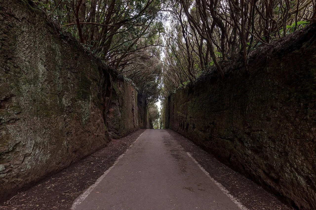
Anaga holds one of the best-preserved stands of laurisilva, the subtropical laurel forest that vanished from most of Europe during the glaciations and survived in Macaronesia. On the ground it means moss-covered trunks, tree ferns, permanent damp and a canopy that muffles sound; the forest captures moisture from the trade-wind cloud, which is why it feels several degrees cooler and much wetter than the coast below.
Walk a short stretch of trail from Cruz del Carmen rather than viewing the forest from the car. The laurel trees close overhead quickly, and the difference between the road and fifty metres into the wood is the difference between a green hillside and a genuinely ancient forest.
Miradors and viewpoints
The viewpoints are what make the drive worthwhile: they frame the barrancos, the ridges and the coast in a way the road itself cannot. The most rewarding stops look back across the massif and down to the sea, and the Roques de Anaga, the volcanic stacks off the north coast, are the landmark to watch for as you descend.
Pull in only where there is a proper lay-by or car park. The road is narrow and the bends are blind, so stopping on a verge to photograph a view is the one habit that turns a good day into a bad one; the signed miradors exist to keep the traffic moving.
Taganana and the hamlets along the north coast road
Taganana is the main village on the north coast, reached by a steep detour off the circuit into a valley of terraced slopes and whitewashed houses. The hamlets nearby are strung along the same road, and the drive down is the moment Anaga changes character from cloud forest to something drier, warmer and agricultural.
This is the part of the park that most rewards slowing down. Park in the village and walk a little, since the lanes are too narrow to explore comfortably by car, and give yourself time to take in the terraces and the way the settlement sits folded into the valley.
The wild beaches below the road
Below the north-coast road lie Benijo, Almáciga and the coves around Taganana, black-sand beaches backed by cliffs and reached by short, steep walks from the parking areas. They are places to look at and linger beside rather than to treat as resort beaches: the surf is powerful and the setting is raw.
The practical cost of visiting them is time and legs. Each beach adds a descent and a climb back to the car, so pick one or two rather than attempting all of them, especially in the afternoon when the light and the cloud both change.
Anaga on foot
Anaga has a dense network of marked trails, from the Sendero de los Sentidos, a short sensory path through the laurel forest, to longer routes across the massif. Near Cruz del Carmen the paths are short, shaded and easy to sample, which makes them the sensible choice if you are combining the forest with the coast in one day.
The Túnel de las Hadas, a passage through the rock and vegetation on one of the forest trails, is a named feature worth seeking out on foot rather than by road. Pick routes from the visitor centre's information and stick to marked paths: the forest is dense and the cloud can reduce visibility fast.
What to expect from the weather
Anaga's weather is driven by the trade winds meeting the massif, which produces persistent mist, high humidity and rapid changes, with the north-east slopes the wettest part of the island. The laurel forest depends on that moisture, so cloud is not bad luck: it is the reason the forest exists.
Dress for damp rather than for the beach, and expect the temperature to drop as you climb into the trees even when Santa Cruz is warm. If the cloud is down and the views are gone, the forest walk at Cruz del Carmen still works; the coastal detours are the part to skip and save for better visibility.
Practical limits: parking and the narrow far end
Plan around two constraints: parking at the main stops, which tightens through the morning in high season, and the narrowest stretch of the circuit, where blind bends and mist demand patience. Both are manageable with an early start and a loop-driven route rather than doubling back on yourself.
Anaga works best as a focused day: the forest and visitor centre in the morning, the coast road and one village in the afternoon, with the drive back to Santa Cruz or La Laguna before the light goes. If you want a gentler day after the mountains, the old town of Santa Cruz is a good counterweight.
Should Anaga be your day out from Santa Cruz?
Yes, if you have a car and half a day to spare, because Anaga is the closest the capital gets to genuinely wild landscape. The trade-off is the drive: narrow roads, blind bends, cloud and contested parking in exchange for laurel forest and a coast of black-sand coves.
Explore more Santa Cruz de Tenerife guides
Frequently Asked Questions
How do you pronounce Anaga?
Say it as ah-NAH-gah, with the stress on the middle syllable and a soft, short final a, in the Spanish way.
What does Anaga mean?
The name is pre-Hispanic in origin and refers to the massif and its people before the Spanish conquest; it is used today for the park, the mountains and the old territory alike.
How long does Anaga Rural Park need?
Half a day covers Cruz del Carmen and the forest with a couple of viewpoints. A full day lets you add the north-coast descent to Taganana and one or two of the beaches below the road.
Sources
Notes for your next Spanish town break
Optional updates to our guides.
You might also like

Continue reading
More guides you'll find useful