Santa Cruz de Tenerife Map: Sights, Streets and How to Get Around
A visitor's map guide to Santa Cruz de Tenerife: how Calle del Castillo, Plaza de España and the port fit together, and which sights sit close enough to walk.
On this page
Santa Cruz de Tenerife is a one-day city on foot: the main monuments and plazas cluster tightly together, so a map of the centre is really a map of a single long walk. What spreads out is the port side and the southern edge, where the Auditorio, the Parque Marítimo and the Palmetum sit away from the shopping streets.
Treat the map as three bands: the pedestrian spine of Calle del Castillo, the old shoreline around Plaza de España, and the waterfront strip running east past the Auditorio. Everything else, including the Museo de la Naturaleza y Arqueología and the Mercado Nuestra Señora de África, slots in between. For the full inventory of sights, see our guide to the things to do in Santa Cruz de Tenerife.
What the Santa Cruz de Tenerife map shows
The city is the capital of Tenerife and shares capital status of the Canary Islands with Las Palmas de Gran Canaria. Until the seventeenth century the island's capital was San Cristóbal de La Laguna, about 10 km inland, and Santa Cruz grew as its port, handling goods and ships bound for the Americas. That history explains the layout: commercial streets running back from the water towards the hillside, with the old town squeezed between.
The port still drives the local economy and the city is a regular call for large international cruise ships, so the waterfront is a working area rather than a promenade. Look on the map for the compact block of plazas and churches near the shore and the greener, wider avenues to the north.
The spine of the centre: Calle del Castillo from Plaza de la Candelaria to Plaza Weyler
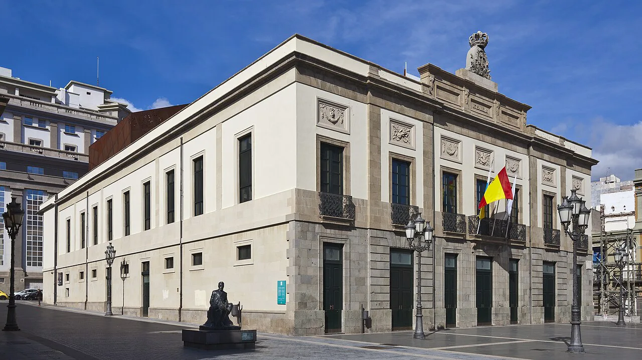
Calle del Castillo is the pedestrian axis to build the day around. Its southern end opens onto Plaza de la Candelaria, the city's central square, and the street runs north to Plaza Weyler, passing the Teatro Ángel Guimerá and the turnings for Plaza del Chicharro. Because it is traffic-free, it works as a handrail: any sight in the centre is a short detour off this line.
Plaza del Príncipe de Asturias and the much larger Parque García Sanabria sit at the northern end of this walkable band, so a loop can finish with shade and benches rather than another church. The old town proper, the tighter streets around the Iglesia de Nuestra Señora de la Concepción, sits between the spine and Plaza de España; our Santa Cruz de Tenerife old town guide picks that area apart street by street.
Plaza de España and the Castillo de San Cristóbal interpretation centre
Plaza de España marks the old shoreline, which is why the Centro de Interpretación Castillo de San Cristóbal is here: the interpretation centre explains the fortification that once guarded this edge of the town. Pair the two rather than treating the square as a quick photo stop, since the underground remains give the open space its meaning.
This is also the natural link between the port and the shopping streets, so it makes sense to start or end the centre loop here. Walk it as a loop rather than an out-and-back and you avoid retracing the same pedestrian streets twice.
The port side: Auditorio, Parque Marítimo and Castillo de San Juan Bautista
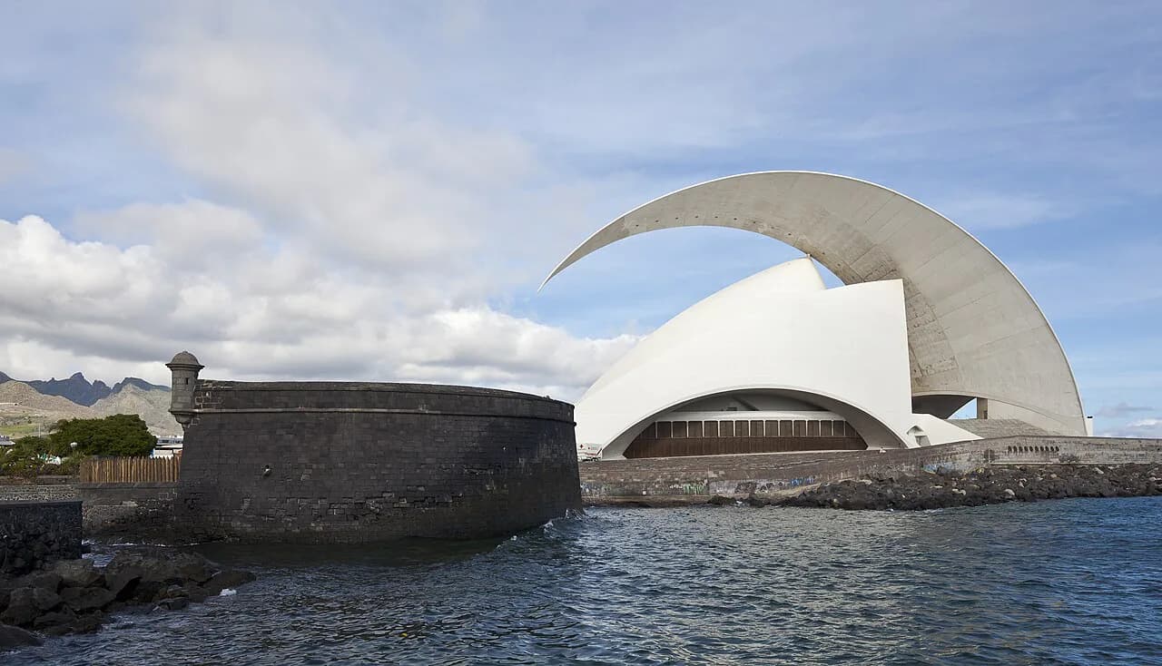
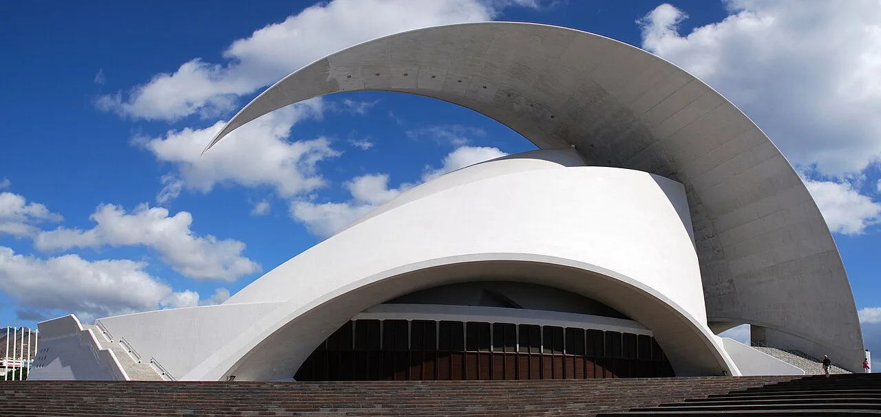
East of the centre, the waterfront strip holds three very different stops. The Auditorio de Tenerife Adán Martín, designed by Santiago Calatrava and opened in 2003, is the home of the Orquesta Sinfónica de Tenerife and stages concerts, dance, opera and musicals; its programme and tickets are published on its own site. The Castillo de San Juan Bautista, known as Castillo Negro, was built in 1643 as part of the city's defences and takes its name from the volcanic stone, though its interior is not open to visitors.
Next door, the Parque Marítimo Cesar Manrique, opened in 1995, was the last work of the Canarian architect and sculptor and offers salt-water pools, a solarium and restaurants. Its published hours run from 10:00 to 19:00 in summer and 10:00 to 18:00 in winter; entry with a sunbed is 5 EUR for adults, 2.50 EUR for over-65s and retirees, 1.50 EUR for children under 12 and free for under-3s, with sunshades at 3 EUR, 1 EUR for over-65s and retirees and free for children under 2.
The best view of the Auditorio is from the Parque Marítimo, which makes the two a single stop on the map rather than separate trips.
The southern outskirts: Jardín Botánico Palmetum by the Recinto Ferial
The Palmetum sits at the entrance to the city beside the Recinto Ferial, on ground that was formerly a landfill, and opened in 2014. It covers 12 hectares and holds more than 600 palm species plus around 3,000 tropical and subtropical plants from around the world. It is open daily from 10:00 to 18:00, and tickets can be booked in advance.
On the map this is the one major sight that clearly falls outside the centre loop, so it earns its own slot in the plan rather than a quick detour between plazas. Give it a separate half-day if palms and tropical planting interest you, and skip it if your time in the city is down to a few hours.
Museo de la Naturaleza y Arqueología, Iglesia de la Concepción and the Mercado
Three indoor stops fill the middle of the map. The Museo de la Naturaleza y Arqueología is the city's natural history and archaeology museum, the Iglesia de Nuestra Señora de la Concepción is the founding parish church, founded in the sixteenth century, and the Mercado Municipal Nuestra Señora de África is the municipal market hall. Together they give you a rainy-hour or midday-heat option without leaving the centre.
Group them in one pass: church, museum, market, then back onto Calle del Castillo. Opening hours vary by day and season and the market keeps different hours from the museum, so confirm each site's own timetable the day before. If you are weighing the city against the island's smaller historic towns, our pick of the best towns in Tenerife helps you decide where the extra day goes.
A walking order that keeps the centre sights in one loop
Start at Plaza de la Candelaria, head north up Calle del Castillo to Plaza Weyler, and branch to Plaza del Príncipe de Asturias and the Parque García Sanabria. Work back south through the old town streets to the Iglesia de la Concepción, then finish at Plaza de España and the Castillo de San Cristóbal interpretation centre. That order finishes near the port.
Keep the port-side trio and the Palmetum for a second pass, because both sit off this loop and stretching the centre walk to include them makes for a lot of pavement. A pause in the Parque García Sanabria is the sensible halfway reset.
Planning a half day in the centre when the map is all you have
With half a day, cut the loop to Calle del Castillo, Plaza de la Candelaria, Plaza de España and the church, and drop the museum or the market rather than rushing both. Add the Museo de la Naturaleza y Arqueología only if the weather pushes you indoors. The city's compactness is the point: you will spend more time looking than moving.
If you have a full day, add the waterfront walk past the Auditorio and the Castillo Negro, and finish at the Parque Marítimo if you want a swim. The Palmetum is a better fit for a longer stay than for a half-day.
Where to get a printable map or callejero before you arrive
The Cabildo de Tenerife publishes tourist maps and town plans through its official tourism site, including city maps for Santa Cruz and La Laguna. The callejero downloads are built on mapping data owned by GRAFCAN and are set up to print on A4, with the option to zoom and reprint at a larger scale. Download the Santa Cruz plan before you travel rather than hunting for one at the port.
For an offline backup, save a street map on your phone and mark the loop before you set out, since the pedestrian centre is easy to navigate but the port-side sights are easy to overshoot.
Which Santa Cruz cluster goes in which day
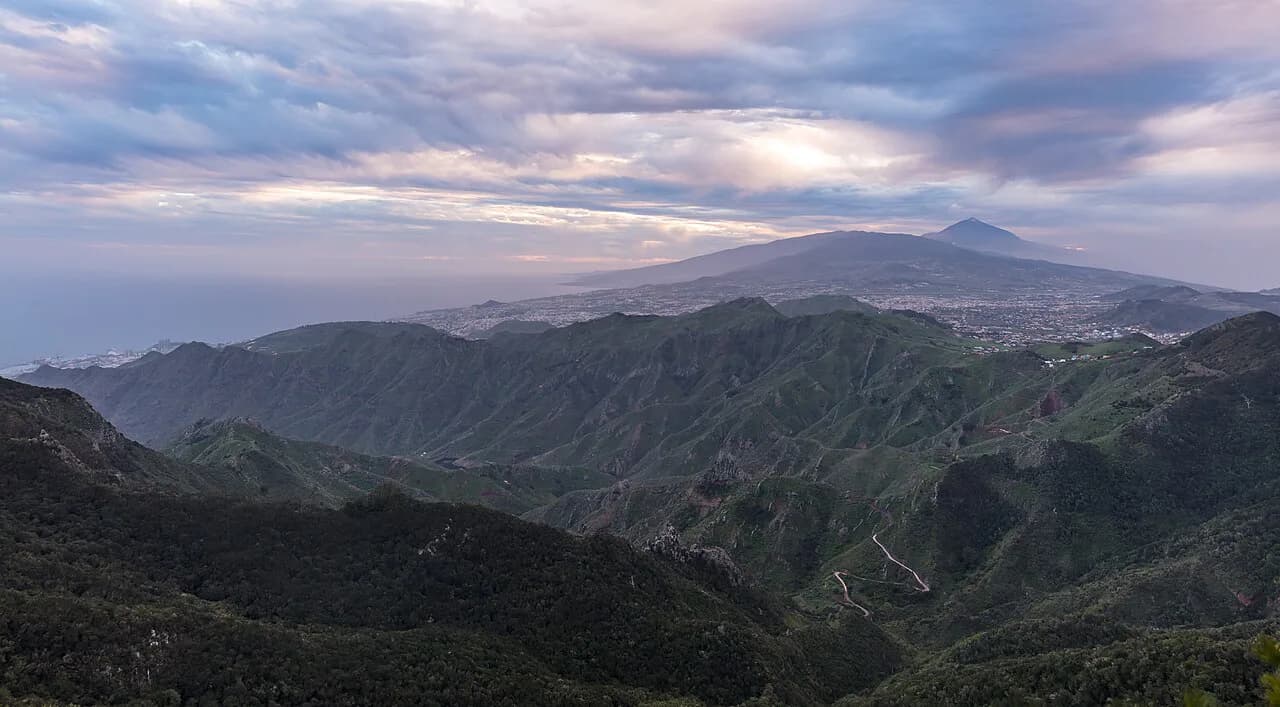
Build the trip around one centre loop: Calle del Castillo, the plazas, the church and Plaza de España, then add either the port-side walk or the Palmetum, not both on the same afternoon. If your break includes time outside the capital, La Laguna is the obvious next town on the map, and Anaga Rural Park is the green counterpoint.
Frequently Asked Questions
Is Santa Cruz in Tenerife worth visiting?
Yes, if you want a compact city day: the main monuments and plazas sit within a short walk of each other, so you can cover the centre on foot and still have time for the waterfront or the Palmetum. It is a working port and capital rather than a resort, so come for the streets, churches and museums rather than a beach.
How far is Santa Cruz de Tenerife from the airport?
The city is served by Tenerife's two airports, but journey times depend on which one you use and on traffic, so check the current timetable and route with the operator or your transfer provider before booking. Allow extra time on cruise-ship days, when the port area is busiest.
Is there a hop-on hop-off bus in Santa Cruz de Tenerife?
City buses and tram services connect the centre with the wider metropolitan area, but routes, frequencies and ticket prices change, so confirm them with the operator on arrival. For the centre itself, walking is the simplest way to link Calle del Castillo, the plazas and the port-side sights.
Where is Santa Cruz de Tenerife on the island map?
Santa Cruz sits on the north-east coast, with La Laguna just inland and the Anaga peninsula to the north-east. It is the island's capital and main port, which is why the historic centre backs directly onto the harbour rather than spreading along a beachfront.
Sources
Notes for your next Spanish town break
Optional updates to our guides.
You might also like

Continue reading
More guides you'll find useful