Zahara de la Sierra: Castle, White Streets and Reservoir Views
Plan a short visit to Zahara de la Sierra: the climb to the castle tower, the Arco de la Villa, Santa María de la Mesa and the best reservoir viewpoints.
On this page
Zahara de la Sierra rewards a half day, not a flying stop: climb to the castle above the village while the morning is cool, then work back down through the old gate, the church and the viewpoints over the reservoir. The village sits on a rocky outcrop in the province of Cádiz, on the edge of the Parque Natural de la Sierra de Grazalema, and the historic centre was declared a conjunto histórico-artístico by royal decree in 1983.
This guide covers the layout of the town, the castle and its Torre del Homenaje, the church of Santa María de la Mesa, the chapel and clock tower on Calle Ronda, and each viewpoint by what it actually shows you. It also sets out the drive from Ronda, the parking problem and how Zahara fits a day among the Pueblos Blancos.
Where Zahara de la Sierra sits
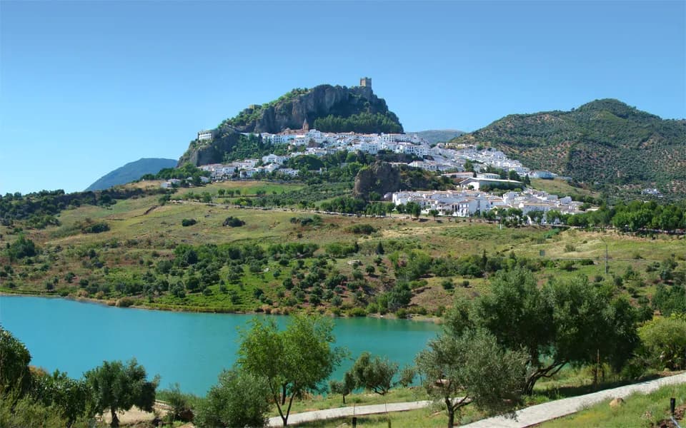
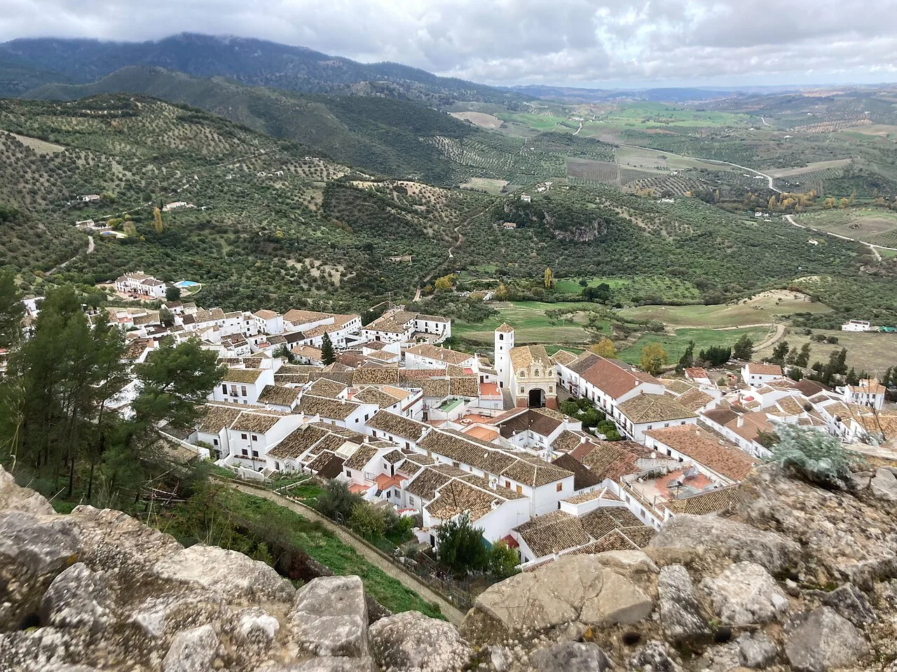
The village is built on a rocky promontory above the Embalse de Zahara-El Gastor. The name distinguishes it from Zahara de los Atunes on the coast, which is a separate place. The surrounding Sierra de Grazalema was declared a UNESCO biosphere reserve, and the area is one of the few places where the pinsapo, the Andalusian fir, survives.
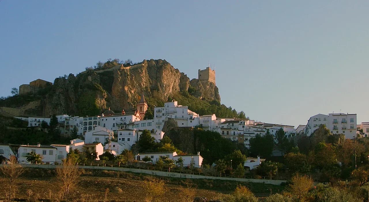
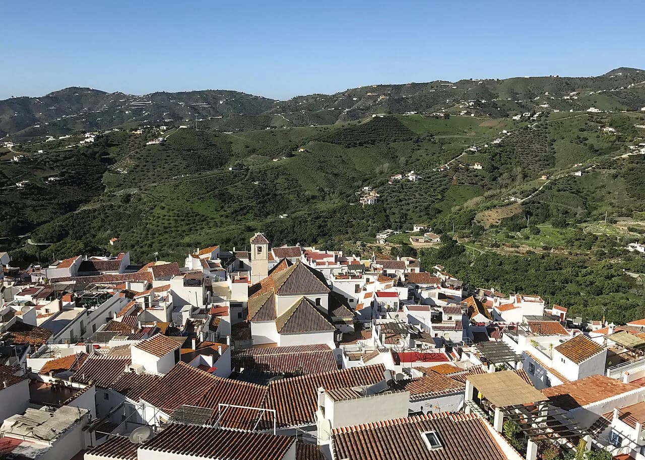
Its setting is the reason to come: the village reads as a pale block crowned by a tower, and the reservoir fills the valley below. Zahara is one of the pueblos blancos of Cádiz province, so it pairs naturally with Grazalema and Setenil de las Bodegas rather than with the coast.
Getting there from Ronda
By car, Zahara is under 40 minutes from Ronda in the province of Málaga, and around 1 hour 25 minutes from Seville via the A-376 and A-375. Those are driving times on the main roads, so treat them as the planning figure for the outward leg and allow more on the winding approach to the village.
Parking is the constraint that shapes a visit. The streets inside the old centre are narrow and steep, so arriving early matters as much for finding a space as for beating the heat. The road up from the reservoir gives the classic view of the village on its rock, so stop there before driving into town rather than after.
Ronda makes the obvious base: it is close enough that Zahara works as a half-day stop rather than somewhere to stay. If you want the broader picture of what else to see in the town, the Ronda Attractions: 6 Visitor Guides collection covers the monuments there.
The lay of the town: Plaza del Rey and Calle Ronda
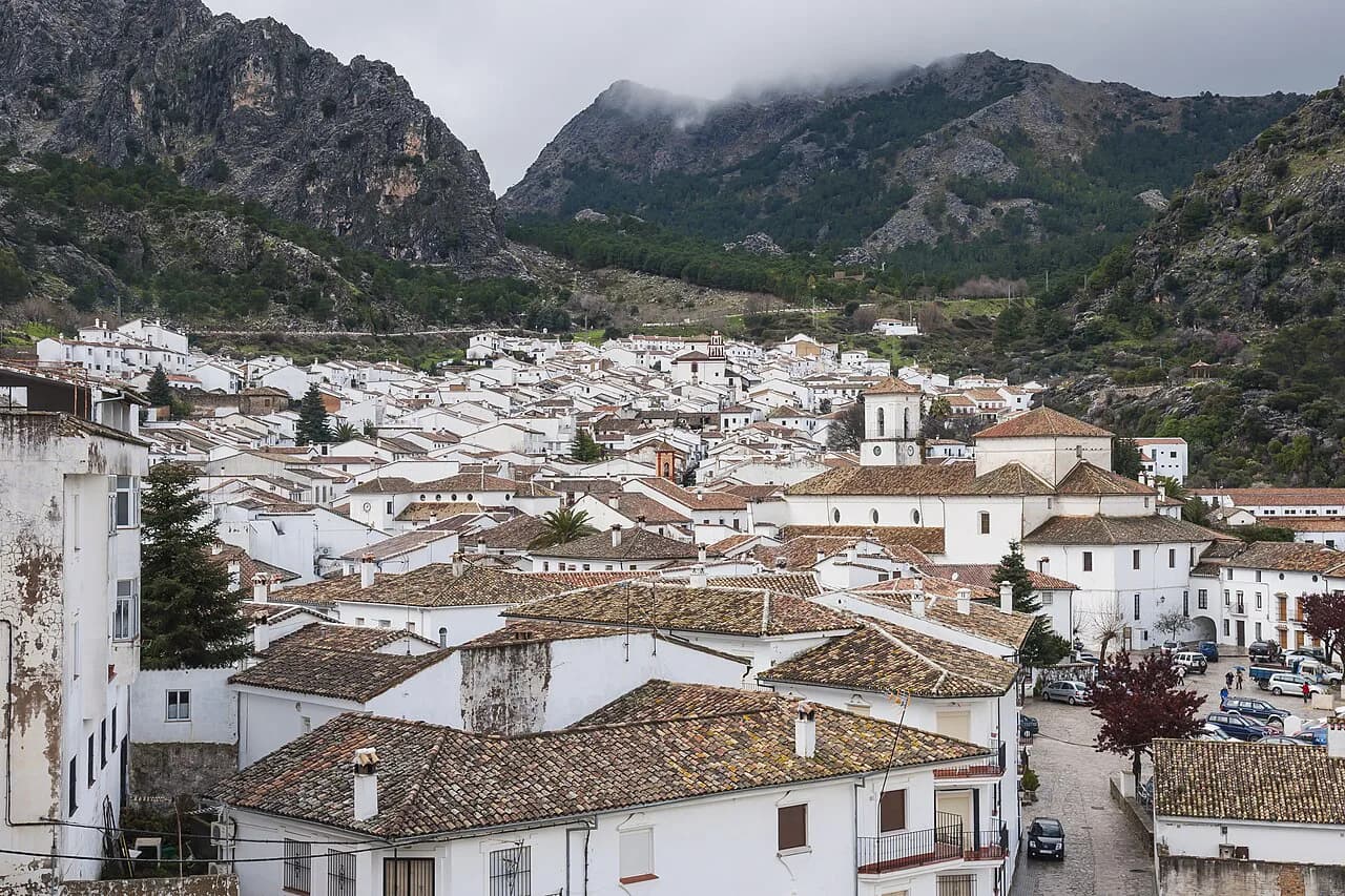
The centre is small enough to walk in an hour without stops. Plaza del Rey holds the Ayuntamiento and the church, and a balcony on the square acts as a mirador over the lower village and the reservoir. From the square, the street becomes Calle Ronda, lined with whitewashed houses, grilled windows and geraniums.
Calle El Fuerte is the one street you need to know by name: it climbs from the old gate to the only entrance to the castle. Walking it in the morning is the sensible order, because the climb is steady and the upper stretch is fully exposed. Allow time to look back on the way up, since the views open out with every turn.
On the way up, a cavity in the rock on your right is known as La Perica, the subject of a local legend about a young woman waiting for her knight. It is a brief pause, not a sight in itself.
The castle and the Torre del Homenaje
The Castillo de Zahara began as a fortress of the Nasrid kingdom of Granada, and its walls and Torre del Homenaje still stand. The castle stands above 600 metres above sea level, and from the tower the panorama takes in the village roofs, the reservoir and, on a clear day, Olvera and Algodonales on their own hills.
The last stretch is a run of stone stairs, which is fine in itself but punishing under an August sun. Go first thing: the stairs are exposed, and the light for photographs across the reservoir is better before midday. Zahara's history gives the climb its weight, from the 1282 meeting at the castle between Alfonso X of Castile and the Marinid emir to the Nasrid seizure in 1481, which served as the pretext for the War of Granada, and the Castilian conquest in 1483.
Arco de la Villa: the old gate and its views
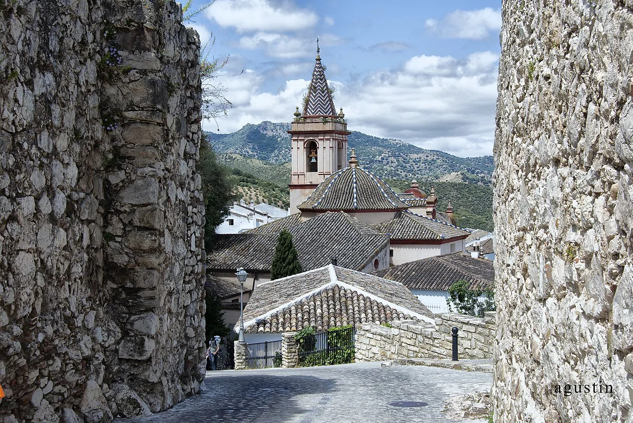
The Arco de la Villa is the former entrance to the medieval town, now partly destroyed: the French blew it up in 1812 as they withdrew. Come for the frame it makes rather than for a complete gate. From the arch you look over the tiled roofs and bell tower of Santa María de la Mesa, and down to the Embalse de Zahara-El Gastor.
Calle El Fuerte begins at the gate and continues to the castle, so the arch is a natural first stop on the climb rather than a separate excursion. Photographers should pause here on the way up and again on the way down, since the light on the white street below changes through the morning.
Iglesia de Santa María de la Mesa
Santa María de la Mesa is an 18th-century baroque church, its facade worked in pink marble and its dome covered in glazed tiles. Inside, the rococo wooden retablo is the piece worth the stop, and there is a small museum within the church. Plans combine baroque with early neoclassical touches, which is why the interior reads differently from the exterior.
Seeing the retablo involves a modest entrance charge; the ticket desk at the church confirms the current amount. If the doors are shut, the square outside is still worth the pause for the facade and the Ayuntamiento. For a higher view of the bell tower, the lane beside the church gains enough height for a photograph.
Calle Ronda: the chapel and the clock tower
Calle Ronda holds two quick sights side by side. The Capilla de San Juan de Letrán is a 19th-century chapel with a broad entrance arch crowned by three espadañas, and inside there is a baroque altarpiece. It was inaugurated in 1956, which explains the mismatch between the older fabric and the modern dedication.
Immediately beside it stands the Torre del Reloj, the clock tower that gives the street its landmark. Neither takes long, so treat them as a pair on the walk between the square and the viewpoints.
The viewpoints, one by one
Each viewpoint in Zahara shows something different, so it helps to know which is which. The road below the village gives the postcard view of the white houses on the rock; the Plaza del Rey balcony looks over the lower town and the reservoir; the Mirador de la Alameda de Lepanto gives a further sweep of the water; and the castle tower gives the highest and widest panorama, towards Olvera and Algodonales.
If you have only an hour, take the castle view and the Arco de la Villa. The remaining viewpoints are level or near-level walks and suit the middle of the day, when the climb is better avoided.
The playita: a hot-day finish
Below the village, the artificial beach by the reservoir is the practical answer to a hot afternoon: a swim and shade rather than another church. It is a small, purpose-built strip rather than a natural beach, so set expectations accordingly. In summer it fills up, and the sensible order is castle first, the playita last.
This is also where Zahara differs from most white villages: the water gives you a genuine second half to the day. Combine it with the reservoir-side road for the view back up to the village on its outcrop.
How long Zahara needs
Half a day covers Zahara comfortably: the climb to the castle, the gate, the church and the walk along Calle Ronda, with time at the viewpoints and, in summer, at the playita. The centre is compact, and the walking is short but steep rather than long.
It works best as a stop on a Pueblos Blancos circuit based in Ronda, with Grazalema and Setenil de las Bodegas on the same loop. Setenil's cave-hung houses on Calle Cuevas del Sol make a strong contrast with Zahara's open hilltop.
Heat and timing
Zahara is inland Andalucía, and midday summer heat is the main thing to plan around. Start early, carry water, and put the castle stairs and the tower first; the shaded lanes and the church interior are better saved for the hottest hours. Shops and church doors in these villages keep their own hours, so plan the day around the streets and viewpoints.
The village also keeps the rhythm of a working hill town, and a couple of local ferias give parts of the year a different character. Check the Ayuntamiento's calendar before fixing dates, since the timing shifts each year.
Castle first, reservoir last
The order that works is castle and tower early, then Calle El Fuerte back down through the Arco de la Villa, the church, Calle Ronda and the lower viewpoints, finishing at the playita on a hot day. Park before the climb, keep the car for the reservoir road, and give the whole visit half a day.
If the white villages are the point of the trip, pair Zahara with Setenil de las Bodegas for a circuit that balances hilltop views with cave streets.
Explore more Ronda guides
Frequently Asked Questions
Is Zahara de la Sierra worth visiting?
Yes, as a half-day stop. The combination of a short climb to a Nasrid castle tower, a partly destroyed medieval gate framing the church roofscape, and reservoir viewpoints gives more shape to the visit than the size of the village suggests.
What is Zahara de los Atunes known for?
It is a different place entirely, a coastal settlement in the same province, and the 'de la Sierra' suffix exists precisely to keep the two apart. Nothing on this page applies to the coast.
Sources
Notes for your next Spanish town break
Optional updates to our guides.
You might also like
Continue reading
More guides you'll find useful