Alicante Map: Old Town, Castle and Stations Layout
An Alicante map for visitors: how the old town, castle hill and Tabarca sit together, plus the official maps and transport apps worth downloading.
On this page
An Alicante map makes sense of the city in one glance: the old town and the castle hill above it form a single block behind the port, the beach runs east along the coast, and Tabarca sits offshore as a boat trip rather than a walk. This guide shows how those areas connect on foot and where the airport bus, the TRAM and the free official maps fit in. It is a planning tool, not a list of everything to see.
Two free downloads do most of the groundwork before you fly. Alicante City & Beach publishes a tourist plan of the city alongside walking routes and a leaflet for the C6 airport bus, and the Comunitat Valenciana tourism board offers its own plano de Alicante as a PDF and flipbook.
What an Alicante map shows you at a glance
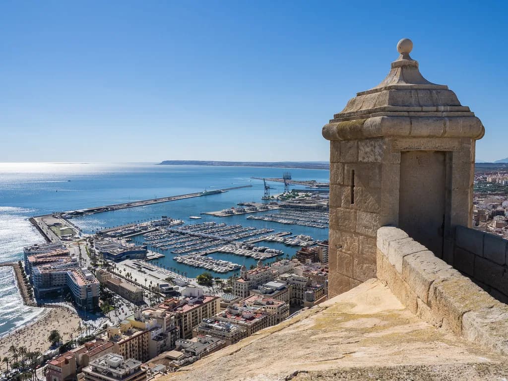
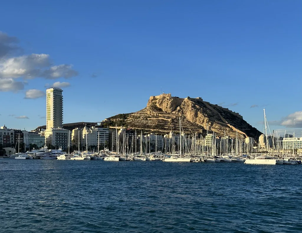
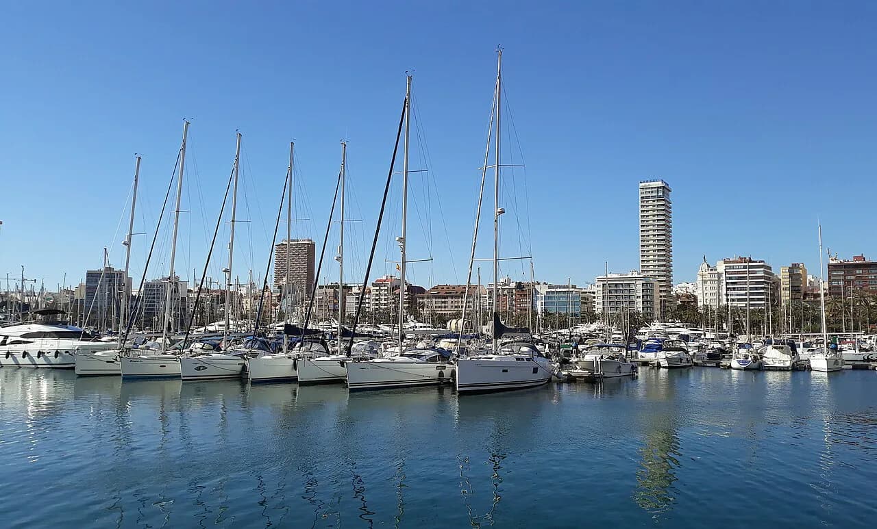
Three shapes dominate the city plan. The port and marina close the southern edge of the centre, the castle hill rises immediately north of it, and the long seafront curves away east towards the beaches. Once you can place those three, most addresses in the centre make sense.
The old town sits pressed against the foot of the hill, its lanes climbing towards the castle rather than spreading out flat. That single fact explains why a short walk in the centre can feel steeper than the map suggests, and why the hill is the natural thing to climb first while you are fresh.
The free official maps to download before you go
The Alicante City & Beach tourism site gathers every city map and leaflet in one place: the tourist plan, a cultural guide, walking routes through the centre, a shopping route, an accessible guide and a separate plan of the metropolitan transport network. Download the tourist plan and the transport plan to your phone before departure and you will not need to hunt for paper on arrival.
The Comunitat Valenciana plano covers the same city at regional-publication quality, available in Spanish, English, French and German as a PDF or a flipbook. It is the better choice if you want a clean printed sheet for marking up, while the city leaflets are stronger on walking routes and practical transport detail.
Reading the centre: old town streets and the castle above them
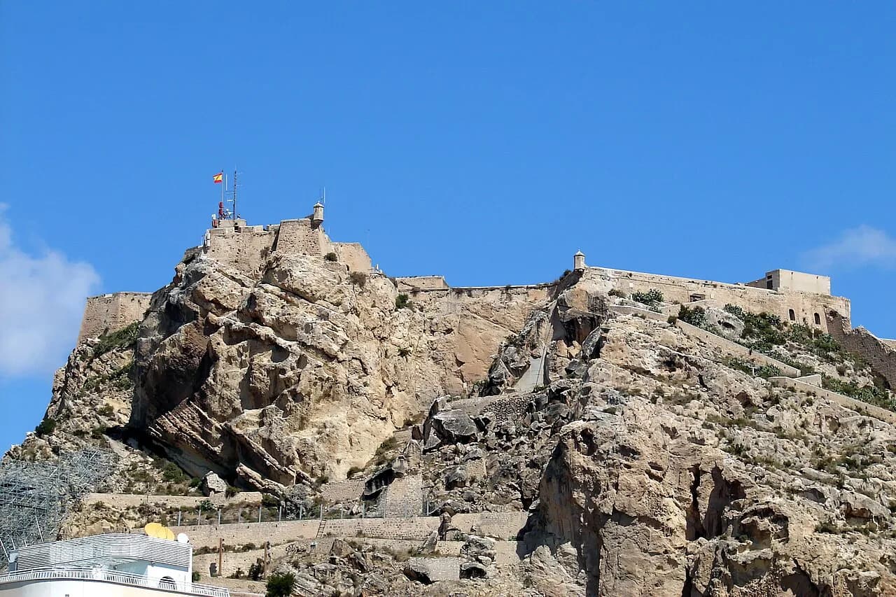
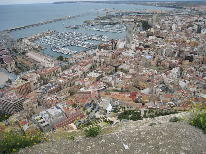
Start your reading of the centre where the old town meets the port, then follow the lanes uphill. The Castillo de Santa Bárbara occupies the summit of the hill directly above these streets, so the castle and the old town are one continuous walk rather than two separate excursions.
The lanes of the Barrio de Santa Cruz climb the same hillside, which is why a map that flattens the slope can mislead. Treat any route between the seafront and the castle as an ascent: it shapes how you order the day far more than raw distance does.
Churches and small museums punctuate the old town and give you natural points to pause on the way up, with the Plaza de Santa María among the squares worth marking before you set out.
Where the beach, the port and Tabarca sit on the plan
The port and marina anchor the bottom of the city plan, and the seafront continues east past the beaches. Everything in that band is a level walk along the coast, so it pairs easily with a morning in the old town and needs no special planning beyond sensible footwear.
Tabarca is the exception on any Alicante map: it is an island offshore, reached by boat and marked on the city leaflets with its own tourist guide and snorkel guide. Plot it as a half-day sea crossing, not a stroll, and keep it off a day you have already filled with the castle.
Arriving from the airport: the bus, the TRAM and the maps that show them
Alicante-Elche airport connects to the city by the C6 bus, which has its own leaflet in the official downloads, and the metropolitan transport plan shows how that service and the urban and interurban bus routes fit together.
The TRAM d'Alacant appears in the same map and app family, described as the operator's tram and train service covering the city, its metropolitan area and the line running between Alicante and Dénia, so the transport materials cover both the bus network and the tram.
Which transport apps replace a paper map on the ground
The official Alicante app list covers the ground well. Bus Alicante is the Subús app for urban lines, stops and waiting times, TRAM d'Alacant is the tram operator's own app, and Aena's flight app handles arrivals and departures at the airport.
Alicante RunAway is described as a free city guide covering cultural points of interest and listed establishments, which makes it a reasonable offline companion to the printed plan.
Planning a short break around the map
On a two- or three-night break, the map suggests a simple order: old town and castle on one day while energy is high, the seafront and port on another, and Tabarca only if the boat timetable suits your arrival and departure. Flights into Alicante-Elche put you closest to this layout; arriving via another airport means a longer transfer and a tighter plan.
Pin your fixed points first, the station or airport bus stop and any booked crossing, then group the rest by area so you are not crossing the centre twice. A map with two clusters marked beats a long list of individual sights.
Map pitfalls: the hill, one-way streets and midday heat
The commonest planning error is treating the castle as a quick add-on. Because it crowns the hill directly above the old town, the climb is the day's main physical effort, and it is worth doing early or late rather than at the hottest hour of an inland summer afternoon.
Drivers get less help from these materials, which concentrate on walking routes, bus and tram. If you only need the centre, the bus and tram network shown on the transport plan removes the need to drive in at all.
Which map to carry for an Alicante break
Take the Alicante City & Beach tourist plan for the centre and its walking routes, add the Comunitat Valenciana plano if you want a clean printed sheet, and install the Subús and TRAM apps for the day itself. With the old town, castle hill, port and Tabarca placed on one mental map, a short break needs no further orientation.
Explore more Alicante guides
Frequently Asked Questions
Does Alicante have an old town?
Yes. The old town sits directly below the Castillo de Santa Bárbara, with lanes such as the Barrio de Santa Cruz climbing the same hillside. It is compact and best read together with the castle rather than separately.
What are the major areas of Alicante for a visitor?
The city divides into the old town and castle hill above the port, the port and marina at the southern edge of the centre, the seafront and beaches running east, and Tabarca offshore. The transport plan also marks the airport bus and TRAM lines that link them.
How do I get an Alicante map before I travel?
Download the Alicante City & Beach tourist and transport plans, and the Comunitat Valenciana plano de Alicante, as PDFs or flipbooks before departure. Both are published online in several languages and are easier to use offline than searching on arrival.
Sources
Notes for your next Spanish town break
Optional updates to our guides.
You might also like
Continue reading
More guides you'll find useful