Arcos de la Frontera: What to See in the Cliff-Top White Town
A practical guide to Arcos de la Frontera: the Plaza del Cabildo, the basilica, the miradors and a short route through the old town above the Guadalete.
On this page
Arcos de la Frontera is best treated as a single tight cluster of monuments on a limestone peña above the Río Guadalete, not a town you tour street by street over a whole day. An hour or two of steady climbing through the old centre takes in the basilica, the Plaza del Cabildo and most of the miradors, with the white houses dropping away to the river meander below. This guide covers what sits where, the order that avoids wasted uphill walking, and how Arcos slots into a break based on Jerez.
The town is one of the gateways to the Ruta de los Pueblos Blancos in the province of Cádiz, and its old centre has been listed as a Conjunto Histórico-Artístico since the 1960s. Its name refers to its medieval position on the frontier with the Nasrid kingdom of Granada, taken by Alfonso X in 1264. What follows assumes you arrive by car or bus and have part of a day, not a fortnight.
Why the old town sits on a cliff above the Guadalete
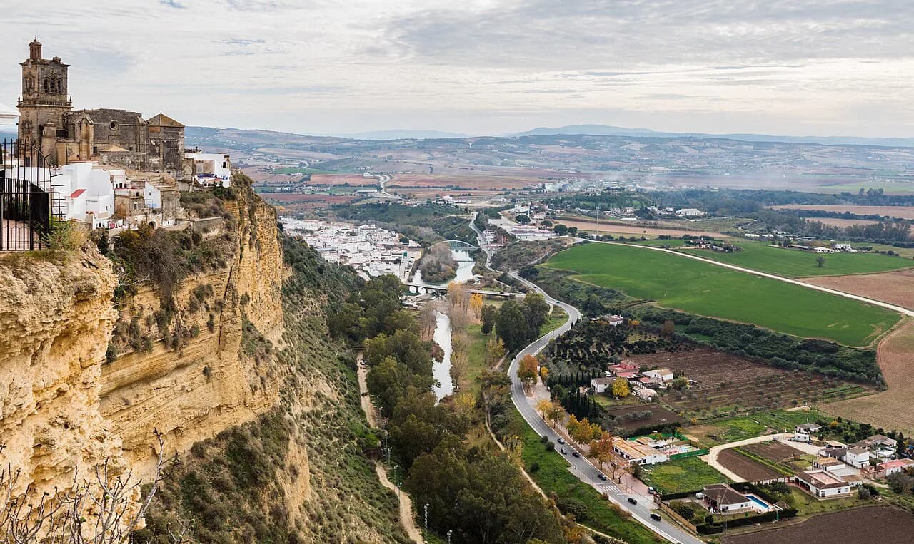
The historic centre occupies the top of a near-vertical crag, with the Guadalete sweeping around its foot in a wide meander. That geography is the whole reason for the layout: defence up top, the river and lower barrio of María Auxiliadora below, and almost every street either climbing or dropping. It also explains why the town feels monumental but small, since the walkable core is compressed into a few hundred metres.
Arcos is a natural add-on to a Jerez trip rather than a destination in its own right, sitting east of Jerez in inland Cádiz and reachable by road from the coast. If you are building a few days around the city itself, our guide to things to do in Jerez covers the bodegas, the Alcázar and the cathedral that anchor the rest of the break.
The lower town is a separate, flatter affair. The barrio of María Auxiliadora begins below the Puerta de Matrera, with the church of the same name, the convent of La Caridad in a colonial style, and the bridge of San Miguel. On a short visit it is what you see from above rather than walk through.
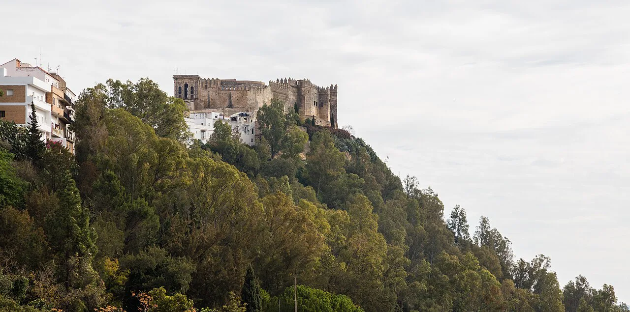
How the old town is laid out: the Cuesta de Belén up to the Plaza del Cabildo
Start at the bottom of the Cuesta de Belén, the steep cobbled street that most visitors climb first. It follows the line of one of the town's old Arab-era gates, which had three arches, a double wall, a barbican, a ditch and a drawbridge before it was demolished in 1852. The street takes its name from a 15th-century Gothic carving of the Virgin that once stood inside the Puerta de Jerez. The Oficina de Turismo sits on the climb and doubles as an interpretation centre with a scale model of Arcos and a town plan to pick up; treat it as your orientation stop before the gradient gets serious.
Halfway up the Cuesta de Belén, look for the Casa Palacio del Conde del Águila, a 15th-century Gothic-Mudéjar house whose facade is the draw.
At the top, a run of stone steps dated 1732 leads to the terrace in front of the basilica and up again to the Plaza del Cabildo. From there the old centre fans out in narrow lanes, so you can work from the highest point downwards instead of doubling back uphill.
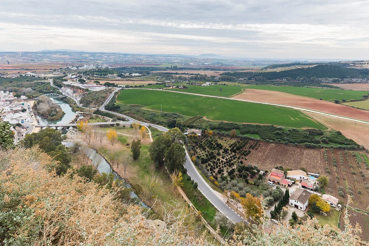
The Plaza del Cabildo, the Mirador de la Peña and the basilica
The Plaza del Cabildo is the town's balcony, with the Mirador de la Peña giving a clean view over the drop to the river and the rooftops below. It is the one spot most visitors photograph, and the natural place to pause before tackling the churches.
The Basílica Menor de Santa María de la Asunción fronts the same upper level. Its main portal blends late Gothic with the emerging Plateresque style, which repays a slow look rather than a quick photo from the steps.
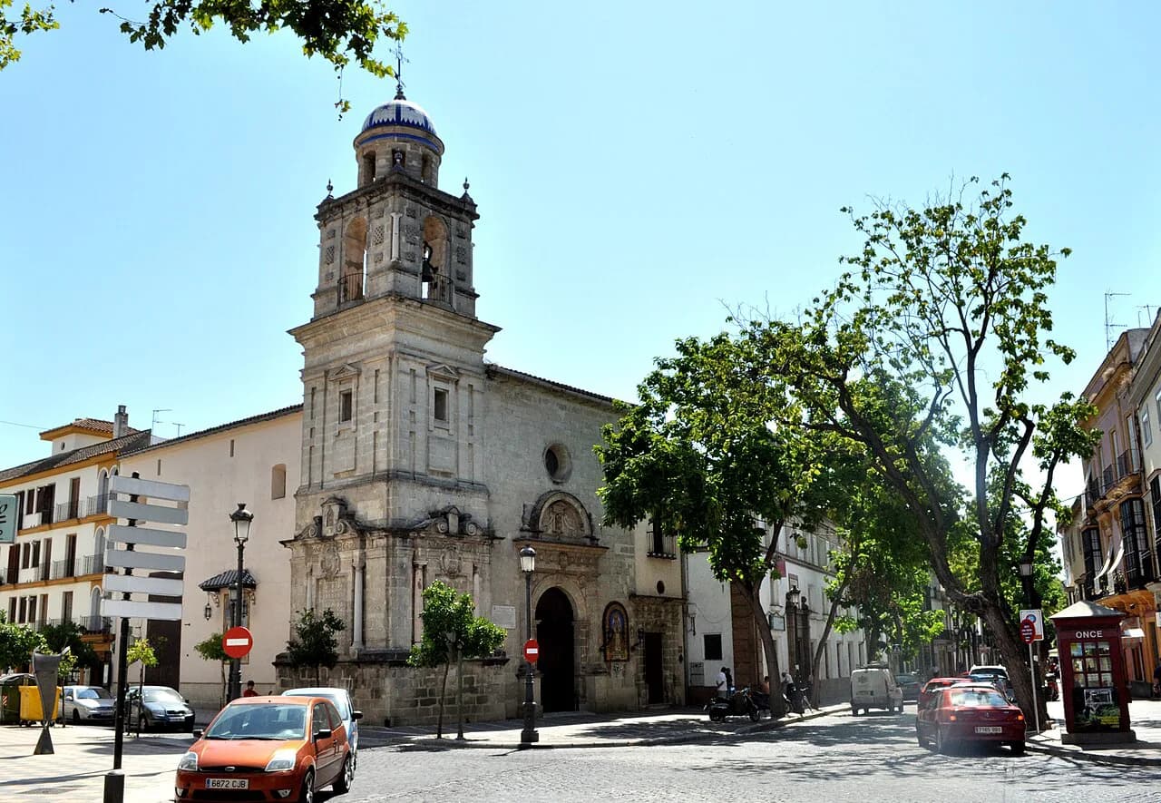
The church of San Miguel, on the Calle Corredera that leads up to the monumental zone, began as a Muslim fortress on a hill until the 15th century, was turned into a hermitage under the name of San Miguel, collapsed after heavy rain in 1684 and was rebuilt in the 18th. Besides a church, it has served as a hospice for orphan girls. It is no longer used for worship and now serves as a cultural hall.
Callejón de las Monjas, Calle Maldonado and the Iglesia de San Pedro
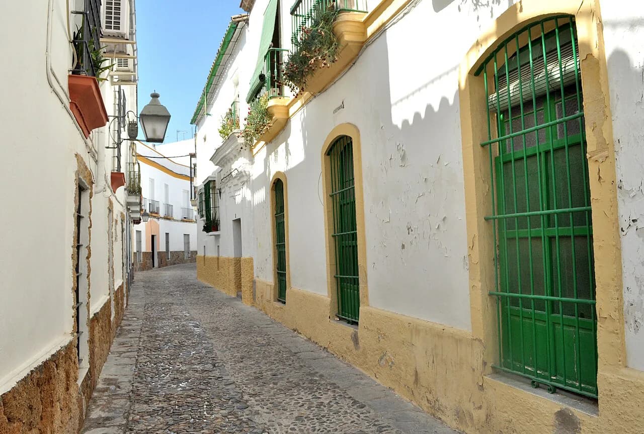
From the north side of Santa María, the Callejón de las Monjas is the lane that gives you the classic shot of white walls and the church together. Continue along Calle Marqués de Torresoto to reach the Convento de las Monjas Mercedarias Descalzas at its end.
The convent is the last enclosed convent left in Arcos, founded in 1642, and the nuns sell pastries through the revolving torno at the entrance. Buy some and keep walking.
Calle Maldonado, the lane beside the convent, is one of the prettiest stretches on the route, with the Iglesia de San Pedro waiting at its far end. The church was built in the 14th century over the remains of an Arab fortress, and its facade is 18th-century Baroque. In between, a nativity scene made by a local association of belenistas is worth a glance.
The Mirador de Abades and the 'Bésame en este Arco' arch
Behind San Pedro, the Mirador de Abades opens up the best panorama in town: the lower village, the river, the church of San Agustín, the remains of the Puerta de Matrera, the reservoir and the Sierra de Grazalema beyond. It is the view that most justifies the climb.
At the entrance to the mirador an arch carries the painted instruction to kiss beneath it, which has become the town's best-known photo stop. Comply, take the picture, and carry on.
Retrace your steps up Calle Abades and continue along the Cuesta del Socorro to reach the Iglesia de San Agustín, which holds one of Arcos's most venerated images, the Nazareno. The mirador outside it looks over the water and the Peña Vieja.
The Puerta de Matrera and the surviving stretch of wall
Follow the street down from San Agustín and you reach the Puerta de Matrera, the only one of the town's three Arab-era gates still standing, with a stretch of the old wall alongside. It marks the edge of the upper centre and the point where the lower barrio begins.
The castle of the Duques de Arcos also sits within the old centre, another fortification layered onto the peña.
Palaces on the route: Conde del Águila, Mayorazgo and its Andalusí garden
The Palacio del Mayorazgo faces San Pedro and dates from the 17th century, with a Herrerian facade and columned courtyards inside. It now houses the Casa de Cultura and rotating exhibitions, so check the cultural agenda if you want to go in rather than just look at the front.
Between the two palaces and the churches, the street wandering itself is the point: Calle Boticas, Calle Cuna in the old Jewish quarter, Calle Nueva and the small Plaza Boticas all sit within a few minutes of each other.
A walking order that works: climb first, then descend through the miradors
Take the sights in this order to keep the hard climbing at the start: Cuesta de Belén and the tourist office, the basilica and Plaza del Cabildo, the Callejón de las Monjas and the convent, Calle Maldonado to San Pedro, the Mirador de Abades, San Agustín, and finally the Puerta de Matrera as you drop towards the lower barrio. Each mirador then arrives as a reward rather than an extra detour.
Expect stairs, cobbles and some steep lanes throughout, and wear shoes that cope with both. There is no flat circuit in the old centre; even the short links between the basilica and San Pedro involve gradient. Allow roughly two to three hours on foot for this route at a civilised pace, longer if you stop for pastries at the torno or linger at the viewpoints.
How Arcos fits a short break from Jerez or Málaga
Arcos works as a half-day excursion from Jerez, and Jerez itself rewards a couple of days, so the two combine easily. If you want the city's monuments and lanes mapped out before you arrive, see the guide to Jerez old town for the Alcázar, cathedral and plazas.
Travellers flying into Málaga can reach inland Cádiz by road, but Arcos then becomes a stop on a longer loop rather than a quick hop; how you get there and how long it takes is a matter for current road and bus timetables. A car gives the most flexibility, while buses link the white towns on fixed schedules. Bring the town's position on the Ruta de los Pueblos Blancos into your planning, since the surrounding sierra is what makes the detour worthwhile.
If your break is built around the city rather than the sierra, our Jerez Attractions hub gathers the individual monument guides in one place, and the Jerez map helps you see how the city and its surroundings connect.
Closures, heat and timing on the climb
Andalusian churches commonly shut to tourists for part of the afternoon, so plan the basilica and San Pedro for the morning or late afternoon and treat the middle of the day as mirador and lane time. In summer the climb up the Cuesta de Belén is exposed, and midday heat on the peña is real; start early or come late.
Some sights have their own patterns: San Miguel is no longer a working church, the Convento de las Mercedarias Descalzas is a closed order selling through the torno, and the Palacio del Mayorazgo depends on what is showing. Confirm the basilica's and San Pedro's visiting arrangements for your dates before you set out.
Where to start: the Oficina de Turismo and its town model
The tourist office on the Cuesta de Belén is the sensible first stop, with a town plan and a model of Arcos to make sense of the levels before you climb. It sits right where the route begins, so you lose no time.
From there the monuments are minutes apart, and the whole old centre can be covered on foot without any transport. Leave the lower town and the reservoir views for the miradors rather than descending.
Should Arcos go into your Jerez itinerary?
Yes, if you want a compact white town with real monuments and a cliff-edge panorama, and you are already in the area around Jerez. The climb is short, the Plaza del Cabildo and the Mirador de Abades deliver the views, and the basilica and San Pedro supply the architecture.
Build it as a half day rather than the centrepiece of a trip, start at the Oficina de Turismo on the Cuesta de Belén, and keep the afternoon for the miradors when the churches close. Pair it with a Jerez day built around the old town and the city's own sights.
Explore more Jerez guides
Frequently Asked Questions
What is Arcos de la Frontera famous for?
For its whitewashed old centre stacked on a cliff above the Guadalete, its basilica and Plaza del Cabildo, and the miradors that look over the river and the Sierra de Grazalema. The Puerta de Matrera, the last of its old gates, and the convent pastries sold through the torno are part of the same picture.
How long do you need in Arcos de la Frontera?
Around two to three hours on foot covers the Cuesta de Belén climb, the basilica, the Plaza del Cabildo, the lanes down to San Pedro and the Mirador de Abades. Add time for church visits and the lower barrio if you have it, and allow a half day including travel from Jerez.
Sources
Notes for your next Spanish town break
Optional updates to our guides.
You might also like
Continue reading
More guides you'll find useful