Las Palmas Map: Old Town, Triana and the Port Laid Out
A practical Las Palmas map guide: Vegueta's cathedral and plazas, Triana's shopping streets, and the beach strip, with walking routes between the quarters.
On this page
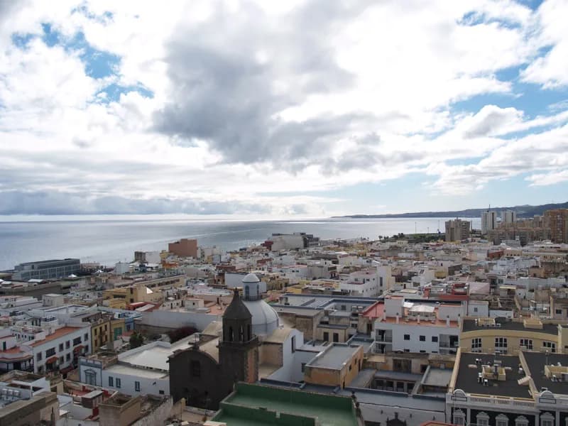
Las Palmas de Gran Canaria is not one walkable centre but two, with the historic south around Vegueta and Triana separated from the northern port and beach strip at Santa Catalina and Playa de Las Canteras. Treat the map as two clusters joined by a short taxi or bus ride, and the city becomes easy to plan. This guide lays out the five visitor areas, the plazas and streets that anchor each one, and how the quarters connect on foot, with a suggested sequence for the southern half in our Las Palmas walking tour.
The city is best read on the map as a southern historic cluster and a northern port-and-beach cluster, with a few residential districts in between; use the quarters below to decide where to base your days rather than trying to tick off a single list.
The main visitor areas at a glance
Vegueta is the founding quarter in the south, a grid of stone streets around the Catedral de Santa Ana. Triana sits immediately east of it, a commercial grid centred on Calle Mayor de Triana, and the two connect across the barranco without a bus. Ciudad Jardín is a leafy residential district north of Triana, Santa Catalina is the port headland with the ferry and cruise terminals, and Playa de Las Canteras with La Isleta forms the long northern beach strip.
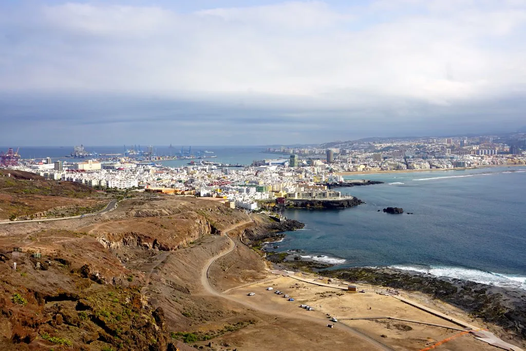
Gran Canaria's capital spreads several kilometres from the historic south to the northern beach strip, so it helps to see how far apart the two clusters sit before committing to a hotel area.
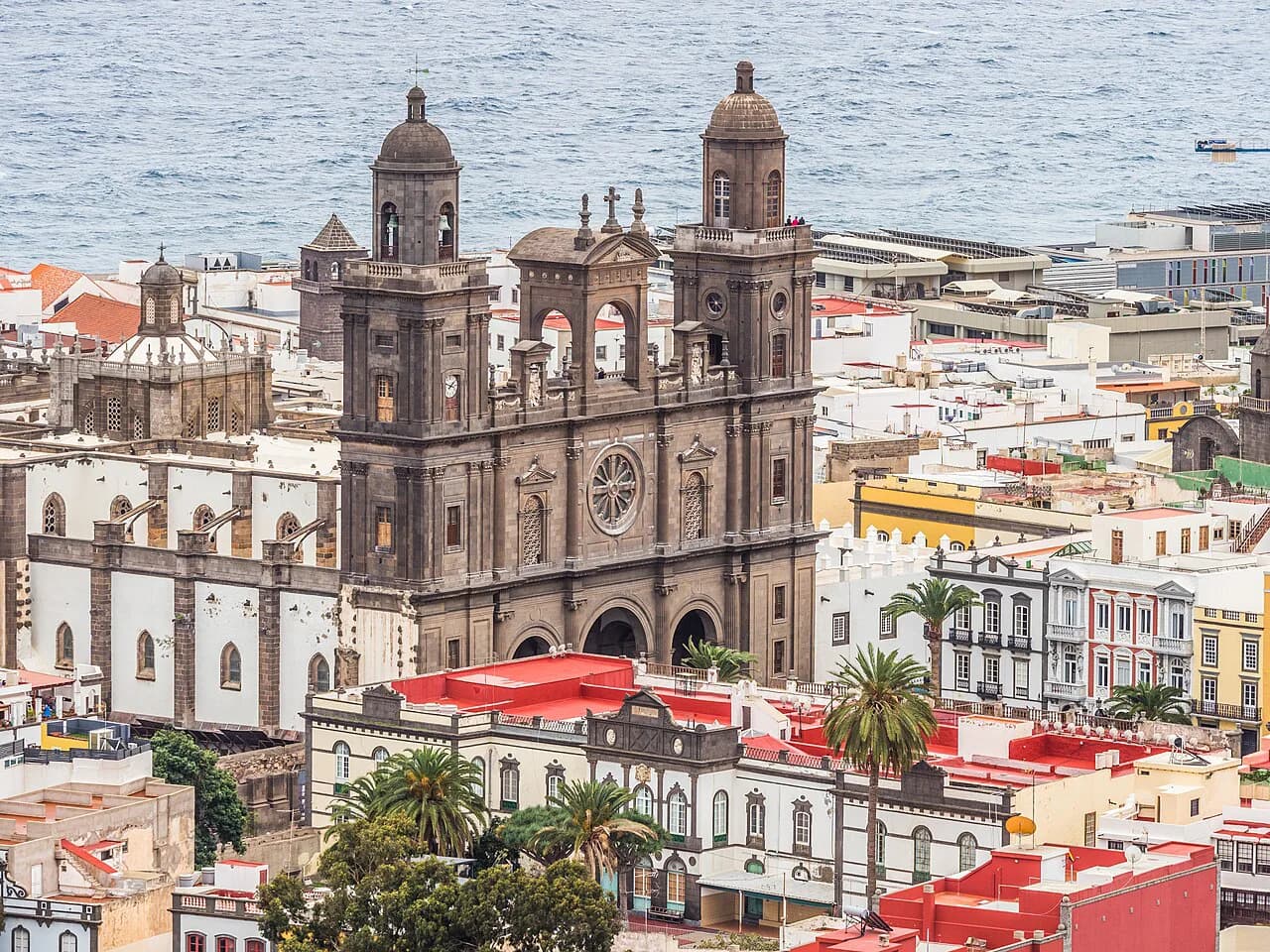
Vegueta: cathedral, plazas and museums in a few minutes
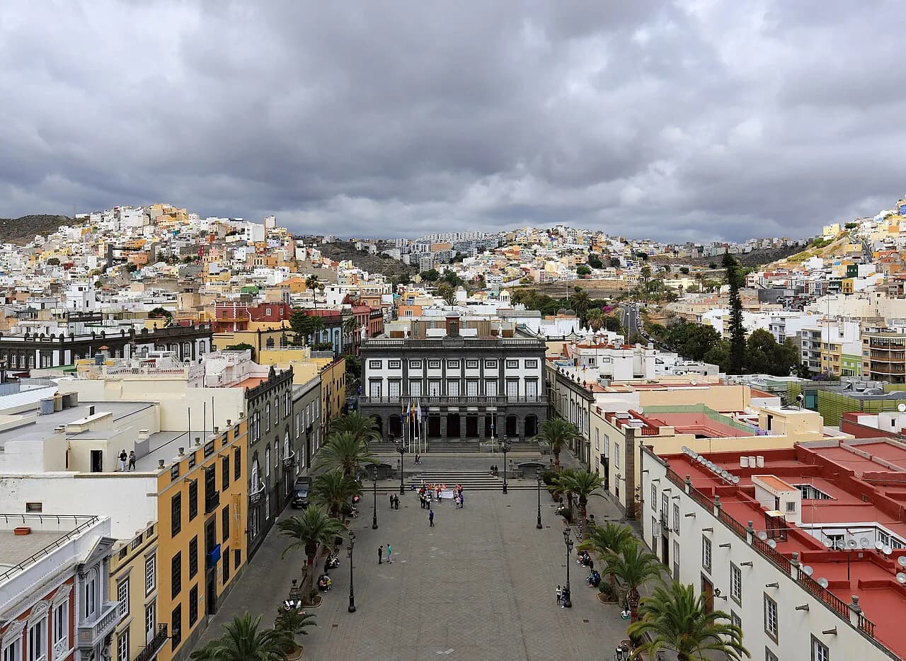
Vegueta is the quarter to learn first, because its sights sit within a few minutes of each other. The Catedral de Santa Ana faces the Plaza de Santa Ana, with the Casas Consistoriales and the Palacio Episcopal around the same square, and the Plaza del Pilar Nuevo and Calle de los Balcones lie just to the south. The Museo Canario and the Casa de Colón are both within this southern grid, so a single morning covers the core without crossing the city.
The city council has publicised a mini-guide to the city's ten essential attractions, which reflects how the historic core is treated as a natural starting point when you read the map.
The historic streets are narrow, one-way for traffic and best covered slowly on foot rather than by car.
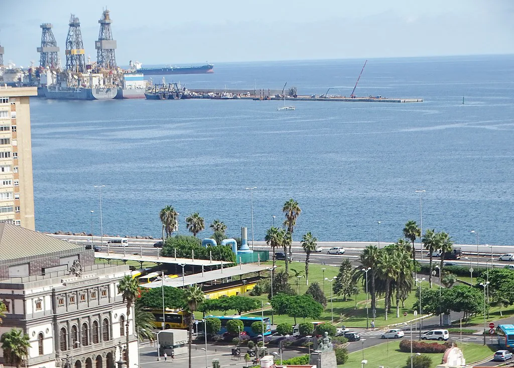
Triana and the walk from Vegueta
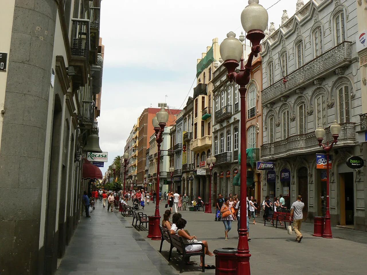
Triana begins where Vegueta ends, across the ravine that separates the two quarters. Calle Mayor de Triana is the spine, a pedestrian shopping street running north from the Vegueta edge towards the Plaza de Cairasco and the Pérez Galdós theatre. The grid either side holds the commercial streets, so the walk from the cathedral to the top of Triana is short and flat enough to do without thinking about transport.
Treat the two quarters as one southern cluster on your map: start at the cathedral, drift east into Triana, and use the shopping streets as a route back rather than a separate outing.
Where the main museums sit
The Casa de Colón sits in Vegueta near the Plaza del Pilar Nuevo, the Museo Canario occupies a townhouse a few streets north, and the Centro Atlántico de Arte is on Calle de los Balcones at the Triana edge. All three fall inside the same southern grid, so a museum morning needs no crossing of the city. Check each institution's own site for opening days and admission, since these vary by museum and season.
A cross-check against a published list of the city's essential sights helps when you plot the museums alongside the historic buildings and the beach and port landmarks.
The port end: Santa Catalina and Castillo de La Luz
North of the old town, the map changes character. Santa Catalina is the headland where the ferry and cruise terminals sit, with the Castillo de La Luz guarding the approach and the Parque de Santa Catalina alongside. This is a separate cluster from Vegueta, and the crossing between the two is a bus or taxi ride rather than a stroll, so plan the port as its own half-day.
From Santa Catalina the map runs east to Playa de Las Canteras, which is why the port and the beach share a visit: the promenade starts at the Santa Catalina end and runs the length of the bay towards La Isleta.
Playa de Las Canteras and La Isleta
Playa de Las Canteras is the long urban beach on the north side, backed by a promenade that runs from near Santa Catalina to the La Isleta peninsula. La Isleta itself is the rocky headland beyond the beach, with the Castillo de La Luz on its southern edge. On the map, the beach strip is a straight line along the coast, which makes it easy to navigate: pick a promenade access point and walk the bay.
This is the area to base a beach-focused break, since the old town is a bus or taxi ride south. If you want both, split the days rather than trying to walk between them.
Gran Canaria Airport and getting into the city
Gran Canaria Airport sits east of the city, so the transfer into Las Palmas is a separate leg of the journey rather than a walk from any quarter. Airport buses and coaches serve the city, so match your stop to where you are staying.
Confirm the current airport bus route and stop on the operator's own timetable before travelling, since the map alone will not tell you which service runs.
Doing it on foot: a one-day loop and a two-day split
On a one-day visit, keep to the south: start at the Plaza de Santa Ana and the cathedral, walk the Vegueta streets to the Casa de Colón, then cross into Triana along Calle Mayor de Triana and finish at the Centro Atlántico de Arte. All of this is on foot and flat, with the ravine crossing the only real transition.
With two days, give the first to Vegueta and Triana, and the second to the port and the beach: Santa Catalina, the Castillo de La Luz, then the promenade at Playa de Las Canteras out towards La Isleta. The city bus connects the two clusters, so the split avoids the long walk between them.
Map the route in advance so you know where the transitions happen, and use our Las Palmas Walking Tour for a worked sequence through the southern quarter.
Map formats
Group the city by its district names — Vegueta, Triana, Ciudad Jardín, Santa Catalina, Playa de Las Canteras, La Isleta — and use them as search terms when you look for a printed or digital map. Pick up a paper copy at a tourist office rather than relying only on a phone.
Download the map you need before you set out, since the old town's narrow streets are easier to navigate with a fixed view of the grid.
Common mapping mistakes
The most common error is treating Vegueta and Playa de Las Canteras as one walkable area: they are at opposite ends of the city, and the walk between them is a bus or taxi journey, not a stroll. The second is heading inland at midday in summer, when the old town's stone streets hold the heat; plan the indoor museum hours for the hottest part of the day.
Keep the two clusters separate on your map, and the city's layout stops being confusing: south for history, north for the port and beach.
Which quarter to base your break around
Base your break in Vegueta or Triana if the cathedral, museums and old-town streets are the point, and accept a bus ride to the beach. Base it near Playa de Las Canteras or Santa Catalina if the promenade and port are the priority, and make the historic quarter a half-day outing.
Whichever you choose, mark the two clusters on your map before you travel and plan transitions between them explicitly. The city rewards that planning: the quarters are coherent, and the map tells you honestly where the gaps are.
Frequently Asked Questions
What are some things to see and do in Las Palmas de Gran Canaria?
The Catedral de Santa Ana and the plazas of Vegueta, the museums in the southern grid, the shopping streets of Triana, the Castillo de La Luz and Santa Catalina at the port, and the promenade at Playa de Las Canteras are the core sights.
How far is Las Palmas, Gran Canaria from the airport?
Gran Canaria Airport lies east of the city, outside the urban districts shown on the island map, so the transfer is a separate journey by bus or taxi rather than a walk from any quarter. Check the current airport bus timetable for the route and stop before travelling.
What currency is used in the Canary Islands?
The Canary Islands use the euro, as elsewhere in Spain. Prices in Las Palmas are quoted in euros, and card payment is widely accepted in the city.
Sources
Notes for your next Spanish town break
Optional updates to our guides.
You might also like
Continue reading
More guides you'll find useful