Ronda Map: Where the Old Town, the Tajo and the Stations Are
A visitor's map of Ronda: how the old town, the Tajo gorge and the new town fit together, the main sights in each area, and where to start walking.
On this page
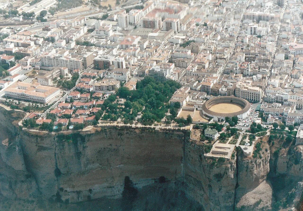
Plan Ronda as two halves split by a gorge: the old town and its walls on the south side, the new town and bullring on the north, with the Puente Nuevo spanning the Tajo between them. Almost everything named here sits within a compact walkable centre, so a paper map or phone map works best when it is organised by zone rather than alphabetically. This guide lays out each zone, the landmarks that orient you and the realistic climbs involved.
The official tourism map for Ronda lists the monuments, churches, parks and city gates that make up the visitable centre, which is a sensible base for marking your own route. Cross-check anything you plan to enter against the same site before you go, since opening times and ticket arrangements sit on individual monument pages rather than the map itself.
Where Ronda sits and how the town fits together
Ronda is an inland town in Málaga province, reachable from the Costa del Sol and from Málaga city, and best understood as a hilltop settlement sliced by the Tajo de Ronda, the deep gorge that separates the old quarter from the newer streets. The result is that any walking route in the centre involves a descent and a climb, even if it looks flat on a map.
The official map divides the town's places of interest into monuments, nature and parks, shops, and experiences, which reflects how the town is laid out: fortress churches and palaces in the old quarter, promenades and the bullring in the newer part, and natural sites beyond the centre. Bookmark the map page and mark the handful of places you actually plan to enter, rather than trying to cover everything in one loop.
The tourism site also groups Ronda's sights under headings such as monuments, architecture and plazas, nature and parks, and experiences, which is a useful key when you are reading the map on the ground. If you are still deciding what to prioritise, the broader list of things to do in Ronda covers the same places in more detail.
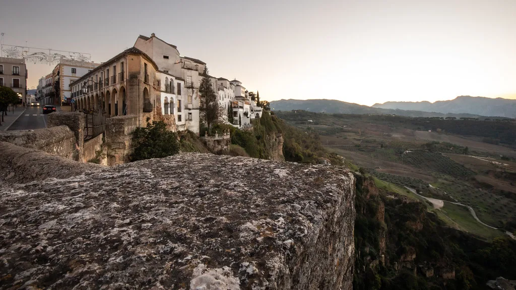
The landmarks that orient you: Puente Nuevo, the Tajo and Alameda del Tajo
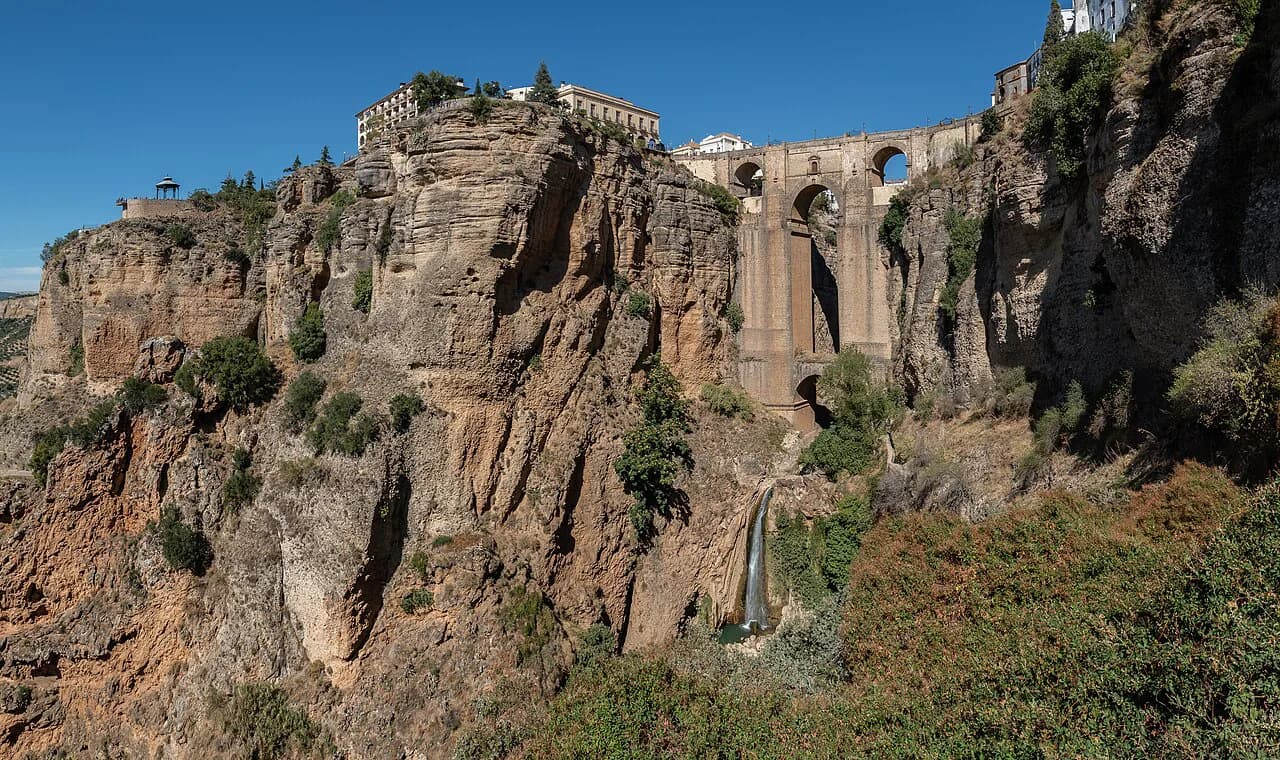
Three landmarks do most of the orienting. The Puente Nuevo is the bridge over the Tajo and the image most associated with the town, the Tajo de Ronda is the gorge itself, and the Alameda del Tajo is the nineteenth-century promenade and garden on the new-town side, with the Teatro Vicente Espinel in the same area.
Once you can see the bridge and the line of the Alameda, the rest of the map falls into place: the bullring and the Paseo de Hemingway sit on the new-town side near the Alameda, while the old town's churches and palaces are across the gorge. A visitor's map of the old town quarter is the best companion for the southern half.
Mapping the old town: churches, palaces and the walls
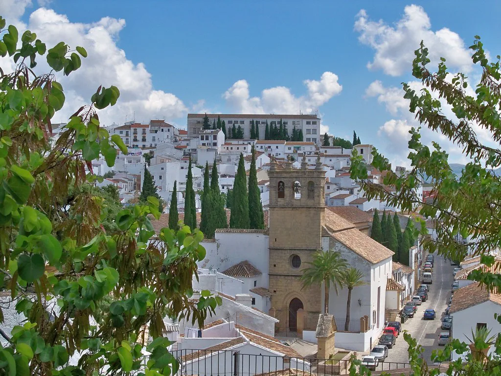
The old town holds most of the monument weight: the Iglesia Santa María La Mayor, the Casa del Gigante, the Casa Museo Don Bosco, the Palacio de Mondragón with the Museo Municipal, and the Iglesia del Espíritu Santo, a church with a fortified appearance. These are close enough together to be walked as one circuit once you are inside the old quarter.
On the edge of that circuit sit the Murallas de Ronda, the defensive walls that enclosed the old city, and the Puerta de Almocabar gate, which is the natural entry point if you approach from the lower eastern side of town. The Baños Árabes, the Moorish bathhouse described as the best preserved of its kind on the Iberian peninsula, and the Ermita rupestre de la Virgen de la Cabeza, a rock-cut chapel, are nearby but lower down.
Treat the Baños Árabes and the rock chapel as a separate short leg rather than part of the main old-town loop, because they sit below the level of the walls. The background to the Islamic town, the walls and the later Christian rebuild is covered in more depth in the Ronda history guide if you want context before walking.
The new town and around the bullring
The new-town side is where the Plaza de Toros, the Paseo de Hemingway, the Paseo Blas Infante and the Paseo de los Ingleses cluster, with the Alameda del Tajo as the spine running out towards the bridge. If you arrive with limited time, this zone and the bridge together give you the classic Ronda panorama without a long climb.
The bullring area is also where guided walks tend to start and finish, and the tourism site sells a Bono Turístico covering the town's main municipal monuments as well as guided visits with an accredited official guide. If you would rather join an organised walk than build your own route, compare the options in the Ronda tours guide.
The new town is also the better half for browsing, with independent shops such as the long-established Cairel gift and souvenir shop listed on the tourism site. The shopping in Ronda guide sets out where the main retail streets run if you want to fold that into the walk.
The miradors on the map
Ronda's viewpoints are spread around the rim of the Tajo rather than concentrated in one place, and each gives a different angle on the bridge and gorge. A two-day itinerary for Ronda names the Mirador de Aldehuela, the Mirador María Auxiliadora, the Mirador del Puente Nuevo, the Mirador La Hoya del Tajo and the Balcón del Coño as the ones worth seeking out.
Mark them on the map as a loop around the gorge rim rather than as individual stops, because several are close together and the walking between them is the point. If viewpoints are your priority, the Ronda viewpoints guide groups them so you can decide which side of the Tajo to walk.
Some of these balconies sit below the street level on the gorge side, so budget for steps down and the climb back. The Balcón del Coño and the Mirador La Hoya del Tajo in particular are reached by paths that drop away from the road.
How to walk between the zones
The centre is walkable, and the honest planning point is elevation rather than distance: the old town sits across the gorge from the new town, and the lower sights such as the Baños Árabes and the Puerta de Almocabar add a descent and a return climb. Build the day so the climbing happens early, then finish on the Alameda or at a mirador near street level.
A simple workable order is the new town and bullring first, the Puente Nuevo second, the old-town monuments third, and the lower Arab baths and walls last if you still have energy. Wear shoes with grip, since the old quarter's streets are paved and sloped rather than stepped throughout.
Arriving by train or bus, and where to leave the car
Ronda's railway station and bus station serve the new-town side, which means you reach the bullring and Alameda before you reach the old town. Confirm your own departure point and timetable with the operator when you book, since services change by season.
If you drive, one guide suggests parking on Calle Prado Nuevo near the Puerta de Almocabar, a short walk from the Puente Nuevo, or higher up on Calle Jaén, from where you can walk down to the Plaza de Toros. Treat those as areas people park rather than guaranteed free spaces, and read the signs and payment machines on arrival.
The Casa del Rey Moro and Islamic Ronda on the map
The Casa del Rey Moro sits on the cornice of the Tajo, and the official map lists it alongside the Murallas and the Baños Árabes as the core of the town's Islamic heritage. Put these on the gorge rim and the lower slope respectively, not in the middle of the old-town church circuit.
The tourism site also lists Aguas de Ronda, an hammam experience next to the Baños Árabes, if you want to pair the historic bathhouse with a modern one. Check what each individual monument includes and when it is open before you set out.
Beyond the town map
Once the centre is mapped, the surrounding area is a separate map. The official site lists Júzcar, the Parque Natural Sierra de las Nieves with the Torrecilla peak, the Parque Natural de Los Alcornocales, the Cueva de la Pileta with its rock paintings and the Cueva del Gato as the natural and village excursions around Ronda.
These sit outside the walkable centre and need their own transport planning, so keep them for a second day rather than squeezing them between monuments. The things to do in Ronda guide covers the wider area in more detail.
Start at the bridge and work outwards
The most efficient way to use a Ronda map is to start at the Puente Nuevo, fix the Alameda and the bullring on the new-town side, then cross into the old town and work through the churches, palaces and walls before dropping to the Baños Árabes. Finish at whichever mirador gives you the view you want rather than trying to tick off every one.
Mark only the places you intend to enter, leave the rest as orientation, and check opening arrangements on each monument's own page before you travel.
Explore more Ronda guides
Sources
Notes for your next Spanish town break
Optional updates to our guides.
You might also like
Continue reading
More guides you'll find useful